Latitude: 54.5235 / 54°31'24"N
Longitude: -1.0787 / 1°4'43"W
OS Eastings: 459726
OS Northings: 514636
OS Grid: NZ597146
Mapcode National: GBR NJX4.77
Mapcode Global: WHF8D.DKKK
Plus Code: 9C6WGWFC+CG
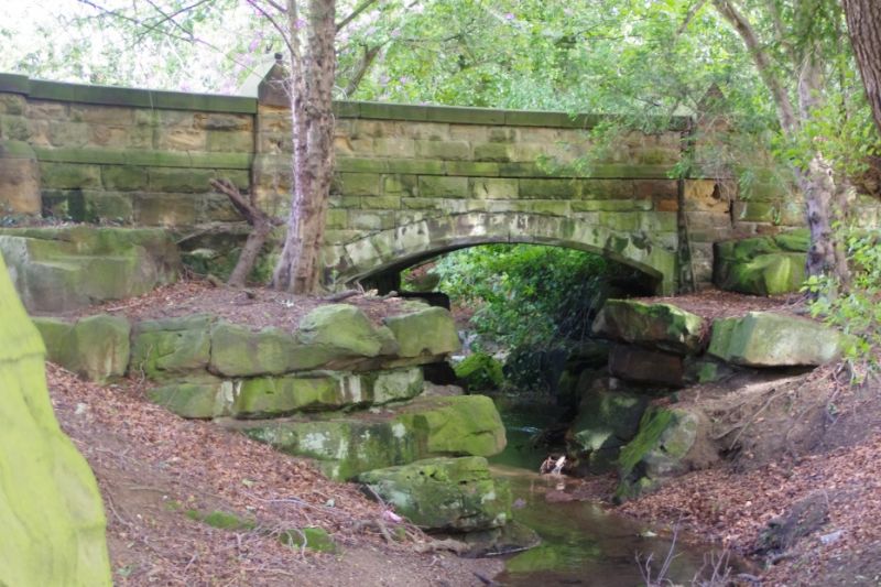
Entry Name: Bridge, 250 Metres to North West of Hutton Hall
Listing Date: 25 April 1984
Grade: II
Source: Historic England
Source ID: 1139782
English Heritage Legacy ID: 59966
ID on this website: 101139782
Location: Hutton Village, Redcar and Cleveland, North Yorkshire, TS14
County: Redcar and Cleveland
Civil Parish: Guisborough
Built-Up Area: Guisborough
Traditional County: Yorkshire
Lieutenancy Area (Ceremonial County): North Yorkshire
Church of England Parish: Guisborough St Nicholas
Church of England Diocese: York
Tagged with: Bridge
NZ51SE GUISBOROUGH HUTTON LOWCROSS 4/100 Bridge, 250 m to N.W. of Hutton Hall.
GV II
Bridge carrying driveway over stream. C.1866. Contemporary with Hutton Hall. Rock-faced sandstone. Segmental arch springing from rough-hewn boulders forming the banks of the stream (and used to form a waterfall to E. of bridge). Carved trefoil motifs on faces of parapet piers. Parapets terminate in short drum inner piers. Included for group value as part of an architectural entity with Hutton Hall.
Listing NGR: NZ5972614636
External links are from the relevant listing authority and, where applicable, Wikidata. Wikidata IDs may be related buildings as well as this specific building. If you want to add or update a link, you will need to do so by editing the Wikidata entry.


Other nearby listed buildings