Approximate Location Map
Large Map »
Latitude: 50.1941 / 50°11'38"N
Longitude: -5.1795 / 5°10'46"W
OS Eastings: 173162
OS Northings: 37519
OS Grid: SW731375
Mapcode National: GBR Z6.3Y9M
Mapcode Global: FRA 081H.V9X
Plus Code: 9C2P5RVC+M5
Entry Name: Footbridge at SW731375
Listing Date: 17 June 1988
Grade: II
Source: Historic England
Source ID: 1142049
English Heritage Legacy ID: 66226
ID on this website: 101142049
Location: Hendra, Cornwall, TR3
County: Cornwall
Civil Parish: Stithians
Traditional County: Cornwall
Lieutenancy Area (Ceremonial County): Cornwall
Church of England Parish: Stithians
Church of England Diocese: Truro
Tagged with: Footbridge
SW 73 NW STITHIANS
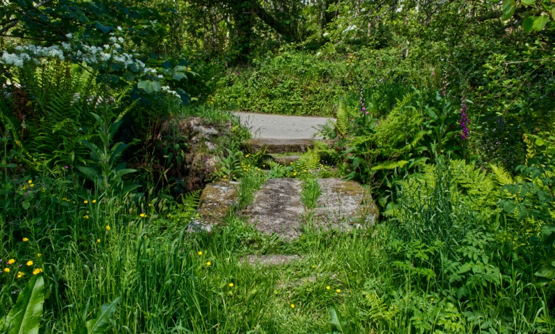
2/429 Footbridge at SW731375
-
II
Footbridge over stream. Circa early C19. Granite rubble with granite monolithic
lintels. Wrought-iron handrail. Single-span bridge of simple lintelled
construction. Handrails are carried on simple iron stanchions. No parapet.
Listing NGR: SW7316237518
External links are from the relevant listing authority and, where applicable, Wikidata. Wikidata IDs may be related buildings as well as this specific building. If you want to add or update a link, you will need to do so by editing the Wikidata entry.


Other nearby listed buildings
