Approximate Location Map
Large Map »
Latitude: 52.2411 / 52°14'27"N
Longitude: 0.7139 / 0°42'49"E
OS Eastings: 585391
OS Northings: 263789
OS Grid: TL853637
Mapcode National: GBR QF0.FBB
Mapcode Global: VHKD4.BX8W
Plus Code: 9F426PR7+CH
Entry Name: Batt House
Listing Date: 12 July 1972
Last Amended: 30 October 1997
Grade: II
Source: Historic England
Source ID: 1142325
English Heritage Legacy ID: 467689
ID on this website: 101142325
Location: Bury St Edmunds, West Suffolk, IP33
County: Suffolk
District: West Suffolk
Civil Parish: Bury St Edmunds
Built-Up Area: Bury St Edmunds
Traditional County: Suffolk
Lieutenancy Area (Ceremonial County): Suffolk
Church of England Parish: Bury St Edmunds St Mary
Church of England Diocese: St.Edmundsbury and Ipswich
Tagged with: House
BURY ST EDMUNDS
TL8563NW WESTGATE STREET
639-1/15/678 (North side)
12/07/72 No.56
Batt House
(Formerly Listed as:
WESTGATE STREET
(North side)
No.56
Bernard Batt House)
GV II
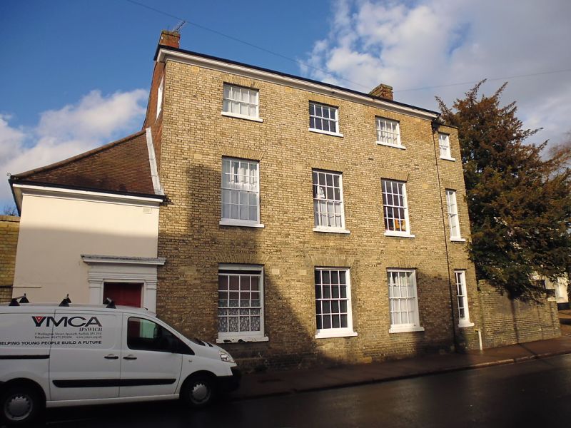
House; now used as the YMCA and divided into 14 bedsits. Early
and later C19 with a fragmentary earlier core. White brick
front, red brick sides and rear; slate roof with a moulded
wood cornice.
EXTERIOR: 3 storeys and cellar; 2 parallel ranges, both C19
but of different date, to the main building; an extension in
matching style on the east side and a small rendered
single-storey section on the west with a tiled and hipped
roof. 3 window range to the main front, all sashes in plain
reveals with flat gauged arches, 16-pane to the ground and 1st
storeys and 8-pane to the 2nd storey. The east extension has a
single narrow sash window to each storey.
The 6-panel door, with the top 2 panels glazed, is within the
west extension: wood doorcase with pilasters and a dentil
cornice.
INTERIOR: extensive cellars, the rear with flint and stone
walling and a brick vaulted ceiling. Only 2 main beams of the
timber frame exposed. An early C19 winder stair which rises to
the top storey has stick balusters and a wreathed handrail.
Listing NGR: TL8539163789
External links are from the relevant listing authority and, where applicable, Wikidata. Wikidata IDs may be related buildings as well as this specific building. If you want to add or update a link, you will need to do so by editing the Wikidata entry.


Other nearby listed buildings
