Approximate Location Map
Large Map »
Latitude: 50.2374 / 50°14'14"N
Longitude: -5.1831 / 5°10'59"W
OS Eastings: 173111
OS Northings: 42341
OS Grid: SW731423
Mapcode National: GBR Z6.13MJ
Mapcode Global: FRA 081D.DLD
Plus Code: 9C2P6RP8+XQ
Entry Name: Cornish Cross Approximately 25 Metres West of Church of Holy Trinity
Listing Date: 12 September 1989
Grade: II
Source: Historic England
Source ID: 1142549
English Heritage Legacy ID: 66905
ID on this website: 101142549
Location: St Day, Cornwall, TR16
County: Cornwall
Civil Parish: St. Day
Built-Up Area: St Day
Traditional County: Cornwall
Lieutenancy Area (Ceremonial County): Cornwall
Church of England Parish: St Day
Church of England Diocese: Truro
Tagged with: High cross
ST DAY CHURCH STREET
SW 74 SW
(east side)
11/340
Cornish cross approx. 25 metres
west of Church of Holy Trinity
GV
II
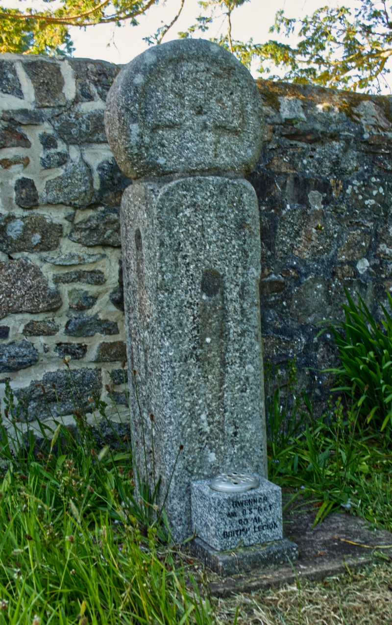
Head of Cornish cross on modern pedestal. Granite. Wheelhead type, with Greek
cross on front and Latin cross on rear, in sunk panels.
Listing NGR: SW7311142341
External links are from the relevant listing authority and, where applicable, Wikidata. Wikidata IDs may be related buildings as well as this specific building. If you want to add or update a link, you will need to do so by editing the Wikidata entry.


Other nearby listed buildings
