Approximate Location Map
Large Map »
Latitude: 50.2122 / 50°12'43"N
Longitude: -5.4811 / 5°28'52"W
OS Eastings: 151733
OS Northings: 40487
OS Grid: SW517404
Mapcode National: GBR DXV3.VGW
Mapcode Global: VH12D.YX6Q
Plus Code: 9C2P6G69+VG
Entry Name: 2, High Street
Listing Date: 22 December 1972
Grade: II
Source: Historic England
Source ID: 1143350
English Heritage Legacy ID: 69024
ID on this website: 101143350
Location: St Ives, Cornwall, TR26
County: Cornwall
Civil Parish: St. Ives
Built-Up Area: St Ives
Traditional County: Cornwall
Lieutenancy Area (Ceremonial County): Cornwall
Church of England Parish: St Ives
Church of England Diocese: Truro
Tagged with: Building
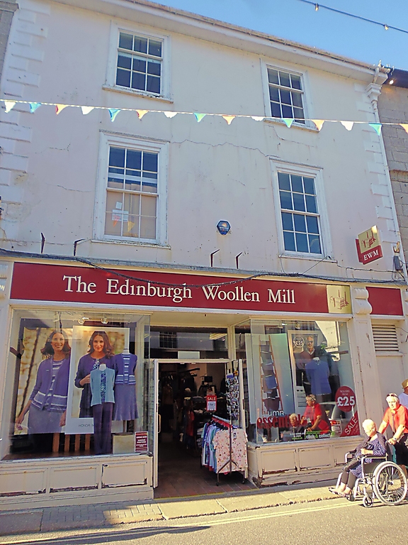
HIGH STREET
1. (North Side)
1587 ------------
No 2
SW 54 SW 1/104
II GV
2.
Early Cl9. Stucco, rusticated quoins. Three storeys. Two windows, sashes
in moulded cases, with glazing bars. Slate roof. Large modern incongruous
shop front. Group value.
All the listed buildings on the North side form a group.
Listing NGR: SW5175640510
External links are from the relevant listing authority and, where applicable, Wikidata. Wikidata IDs may be related buildings as well as this specific building. If you want to add or update a link, you will need to do so by editing the Wikidata entry.


Other nearby listed buildings
