Approximate Location Map
Large Map »
Latitude: 50.2109 / 50°12'39"N
Longitude: -5.4794 / 5°28'45"W
OS Eastings: 151848
OS Northings: 40332
OS Grid: SW518403
Mapcode National: GBR DXV4.2WG
Mapcode Global: VH12D.ZY3R
Plus Code: 9C2P6G6C+86
Entry Name: 3, the Terrace
Listing Date: 22 December 1972
Grade: II
Source: Historic England
Source ID: 1143303
English Heritage Legacy ID: 69114
ID on this website: 101143303
Location: St Ives, Cornwall, TR26
County: Cornwall
Civil Parish: St. Ives
Built-Up Area: St Ives
Traditional County: Cornwall
Lieutenancy Area (Ceremonial County): Cornwall
Church of England Parish: St Ives
Church of England Diocese: Truro
Tagged with: Building
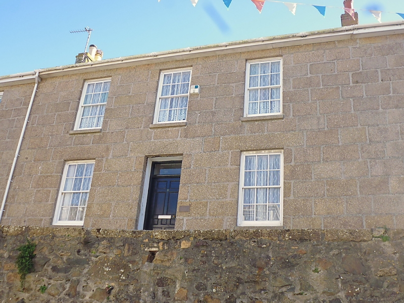
THE TERRACE
1. -----------
1587 No 5
SW 54 SW 1/155
II GV
2.
Early C19. Granite ashlar. Two storeys. Three windows, sashes with glazing
hers, Central doorway, panelled door, plain rectangular fanlight, Slate.
roof. Group Value.
Nos 1 to 4 (consec) form a group.
Listing NGR: SW5184840332
External links are from the relevant listing authority and, where applicable, Wikidata. Wikidata IDs may be related buildings as well as this specific building. If you want to add or update a link, you will need to do so by editing the Wikidata entry.


Other nearby listed buildings
