Approximate Location Map
Large Map »
Latitude: 50.2104 / 50°12'37"N
Longitude: -5.479 / 5°28'44"W
OS Eastings: 151875
OS Northings: 40282
OS Grid: SW518402
Mapcode National: GBR DXV4.33K
Mapcode Global: VH12D.ZZB2
Plus Code: 9C2P6G6C+59
Entry Name: 2 and 3, Albert Road
Listing Date: 22 December 1972
Grade: II
Source: Historic England
Source ID: 1143388
English Heritage Legacy ID: 68919
ID on this website: 101143388
Location: St Ives, Cornwall, TR26
County: Cornwall
Civil Parish: St. Ives
Built-Up Area: St Ives
Traditional County: Cornwall
Lieutenancy Area (Ceremonial County): Cornwall
Church of England Parish: St Ives
Church of England Diocese: Truro
Tagged with: Building
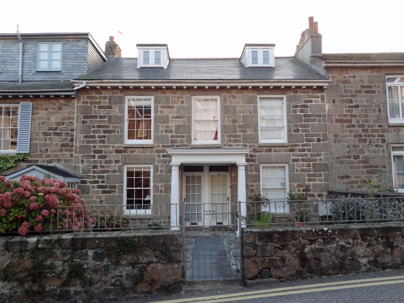
ALBERT ROAD
1. -----------
1587 Nos 2 & 5
SW 54 SW 1/16
II GV
2.
Early C19. Coursed masonry with granite quoins and lintels. Two storeys.
Three windows, sashes with glazing bars. Adjoining central doorways, glazed
door, plain rectangular fanlights, wooden openwork porches with pointed
arches, over-hanging eaves. New slate roof.
Nos 2, 3 and 4 form a group.
Listing NGR: SW5187540282
External links are from the relevant listing authority and, where applicable, Wikidata. Wikidata IDs may be related buildings as well as this specific building. If you want to add or update a link, you will need to do so by editing the Wikidata entry.


Other nearby listed buildings
