Approximate Location Map
Large Map »
Latitude: 50.2073 / 50°12'26"N
Longitude: -5.4978 / 5°29'51"W
OS Eastings: 150522
OS Northings: 40003
OS Grid: SW505400
Mapcode National: GBR DXT4.6HY
Mapcode Global: VH12L.N1FW
Plus Code: 9C2P6G42+WV
Entry Name: Rosedale
Listing Date: 22 December 1972
Grade: II
Source: Historic England
Source ID: 1143346
English Heritage Legacy ID: 69018
ID on this website: 101143346
Location: Cornwall, TR26
County: Cornwall
Civil Parish: St. Ives
Built-Up Area: St Ives
Traditional County: Cornwall
Lieutenancy Area (Ceremonial County): Cornwall
Church of England Parish: Halsetown
Church of England Diocese: Truro
Tagged with: Building
HELLESVEAN ROAD
1. HELLESVEAN
1587 ---------------
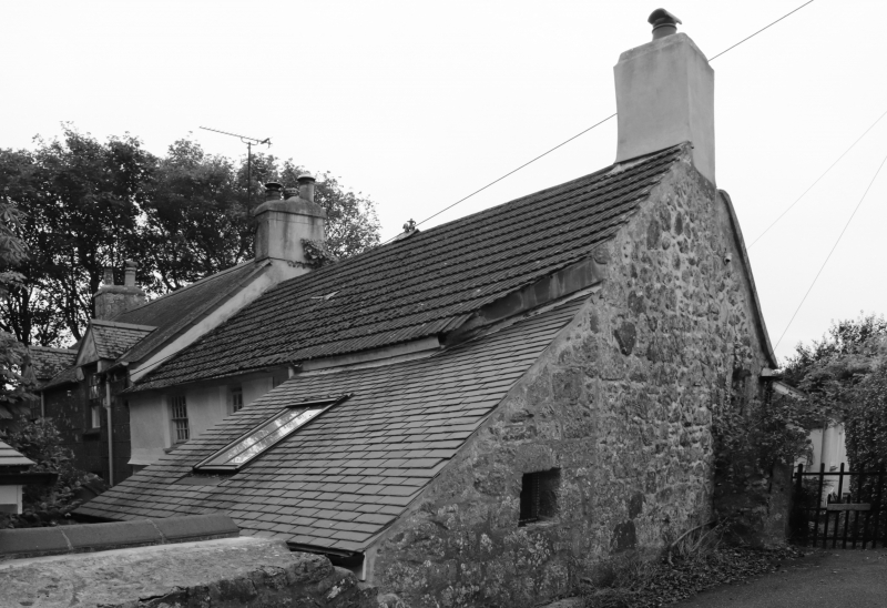
Rosedale
SW 54 SW 3/205
SW 55 NW 5/205
II GV
2.
C18. Painted rubble, rendered first floor. Two storeys. Three windows,
sashes, some have glazing bars. Modern bay on ground floor left. Central
fielded-panel door partly glazed. Flat roof porch with slender columns.
Lean-to on right New tile roof.
Dr Stack's House Corner Cottage Penrose Cottage, Rosedale and Treesdale
form a group.
Listing NGR: SW5052240003
External links are from the relevant listing authority and, where applicable, Wikidata. Wikidata IDs may be related buildings as well as this specific building. If you want to add or update a link, you will need to do so by editing the Wikidata entry.


Other nearby listed buildings
