Latitude: 50.2073 / 50°12'26"N
Longitude: -5.4977 / 5°29'51"W
OS Eastings: 150522
OS Northings: 39998
OS Grid: SW505399
Mapcode National: GBR DXT4.6HY
Mapcode Global: VH12L.N1FX
Plus Code: 9C2P6G42+WW
Entry Name: Treesdale
Listing Date: 22 December 1972
Grade: II
Source: Historic England
Source ID: 1312609
English Heritage Legacy ID: 69019
ID on this website: 101312609
Location: Cornwall, TR26
County: Cornwall
Civil Parish: St. Ives
Built-Up Area: St Ives
Traditional County: Cornwall
Lieutenancy Area (Ceremonial County): Cornwall
Church of England Parish: Halsetown
Church of England Diocese: Truro
Tagged with: Building
HELLESVEAN ROAD
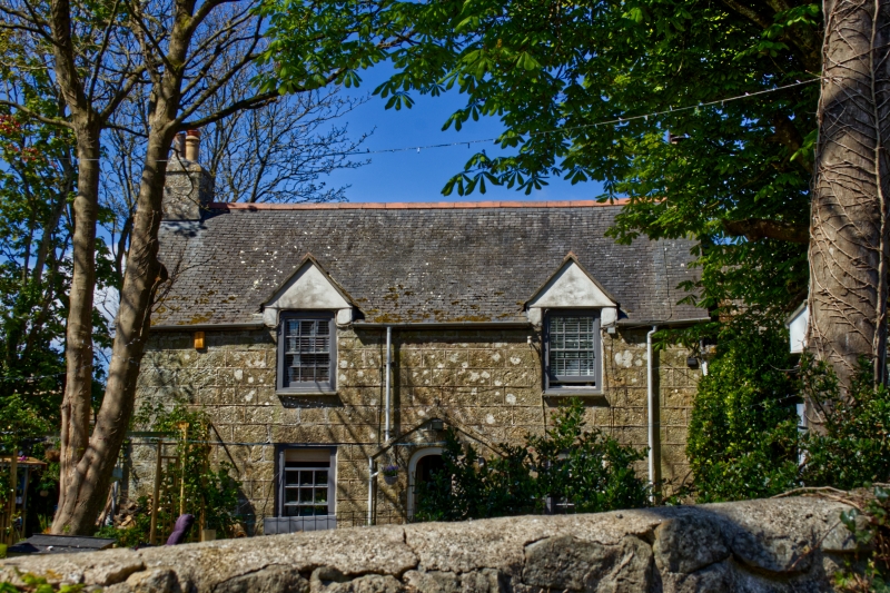
1. HELLESVEAN
1587 ---------------
Tressdale
SW 54 SW 3/205
SW 55 NW 5/205
II GV
2.
C18. Dressed granite blocks. Two storeys. Two windows, sashes with
glazing bars, those on first floor in small gable heads. Gabled stone
porch, coping, basket arch. Sturried slate roof with gable ends.
Dr Stack's House Corner Cottage Penrose Cottage, Rosedale and Treesdale
form a group.
Listing NGR: SW5052239998
External links are from the relevant listing authority and, where applicable, Wikidata. Wikidata IDs may be related buildings as well as this specific building. If you want to add or update a link, you will need to do so by editing the Wikidata entry.


Other nearby listed buildings