Latitude: 50.6919 / 50°41'30"N
Longitude: -4.6983 / 4°41'53"W
OS Eastings: 209513
OS Northings: 91496
OS Grid: SX095914
Mapcode National: GBR N3.5QZK
Mapcode Global: FRA 1717.X0L
Plus Code: 9C2QM8R2+PM
Entry Name: South Harbour Pier, Quay and Walls on South West Side of Harbour
Listing Date: 17 December 1962
Grade: II*
Source: Historic England
Source ID: 1143473
English Heritage Legacy ID: 68721
ID on this website: 101143473
Location: Cornwall, PL35
County: Cornwall
Civil Parish: Forrabury and Minster
Built-Up Area: Boscastle
Traditional County: Cornwall
Lieutenancy Area (Ceremonial County): Cornwall
Tagged with: Wharf
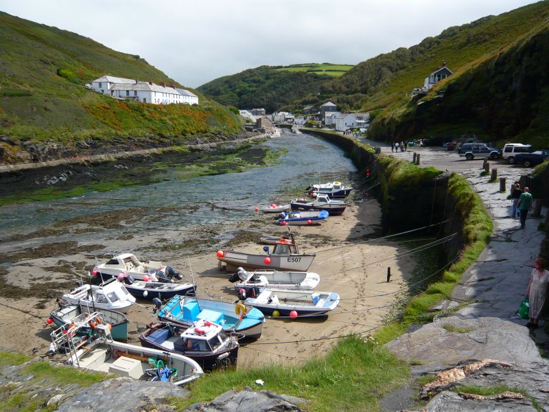
FORRABURY AND THE HARBOUR, Boscastle SX 09 SE MINSTER 1/61 South harbour pier, quay and walls 17.12.62 on south west side of harbour GV II* Harbour pier, quay and walls on south west side of harbour. Circa 1584. Slate stone rubble and quartz. The pier is constructed of vertically coursed rubble, partly rebuilt on the east. It projects from the west, curving gently and giving protection to the natural harbour on the south. The outer seaward side is raised and there is a cobbled path with slip on the leeward, south side. The south west wall of the harbour is largely constructed of vertically coursed slate stone rubble, interspersed with natural outcrops of rock. Quay directly to south of southern harbour pier with high cliff to west. The north east side of the harbour is enclosed by natural outcrops of rock. A pier had been erected at Boscastle by 1547 and in 1549 The Church of St. Thomas, Launceston, had contributed towards the repair of the quay. In circa 1584, a memorandum was drawn up by the townsmen of Boscastle, at the request of Sir Richard Grenville, Sheriff of Cornwall; this sets out full details of the wages paid out in the first 14 months of work on the rebuilding of the pier. A letter from Grenville gives full details of the dimensions which correspond closely with those of the existing pier. The pier was restored in 1740 by Mr Cotton Amy and in C18 an outer bar was built. The latter was destroyed during World War II and reconstructed in 1962 reusing stone from the demolished Laira Bridge, Plymouth. The busy port of Boscastle exported corn, roof slates and bark for leather tanning; between circa 1815 and 1840 exporting manganese ore from the mines near Launceston and after 1865 china clay from Bodmin Moor. Imports included wine and spirits, pottery, coal, manure and limestone. A description of the port in 1861 described the numerous warehouses, workshops, shipyards and timber yards. This is a fine early harbour structure in a particularly picturesque setting. Pearse, Richard The Ports and Harbours of Cornwall 1963 Williams, Michael Boscastle 1978
Listing NGR: SX0951391496
External links are from the relevant listing authority and, where applicable, Wikidata. Wikidata IDs may be related buildings as well as this specific building. If you want to add or update a link, you will need to do so by editing the Wikidata entry.


Other nearby listed buildings