Approximate Location Map
Large Map »
Latitude: 50.1191 / 50°7'8"N
Longitude: -5.5363 / 5°32'10"W
OS Eastings: 147303
OS Northings: 30323
OS Grid: SW473303
Mapcode National: GBR DXQC.DTX
Mapcode Global: VH12Z.080K
Plus Code: 9C2P4F97+JF
Entry Name: 40 and 41, Market Place
Listing Date: 7 February 1974
Grade: II
Source: Historic England
Source ID: 1143941
English Heritage Legacy ID: 69522
ID on this website: 101143941
Location: Penzance, Cornwall, TR18
County: Cornwall
Civil Parish: Penzance
Built-Up Area: Penzance
Traditional County: Cornwall
Lieutenancy Area (Ceremonial County): Cornwall
Church of England Parish: Penzance St John the Baptist
Church of England Diocese: Truro
Tagged with: Building
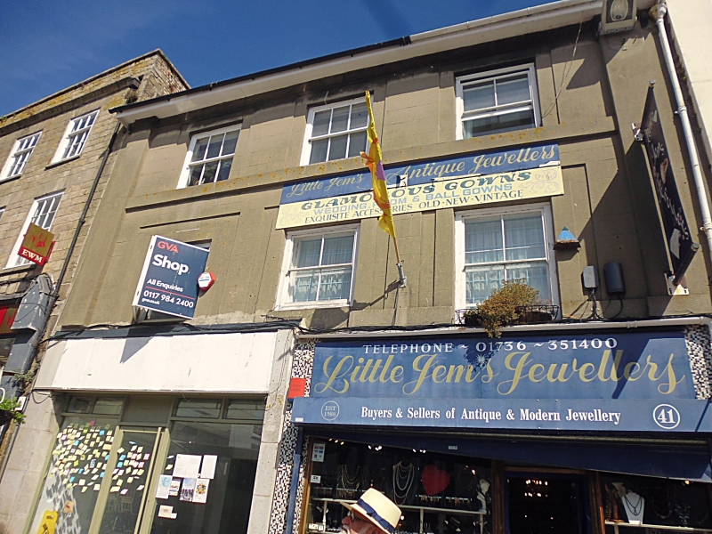
1.
1498 PENZANCE
MARKET PLACE
(North Side)
Nos 40 and 41
SW 4730 5/514
II GV
2.
Early C19. Rendered. Slate roof, wide eaves. End pilasters to 1st and 2nd
floors. Band. 2 storeys. 3 windows in recessed surrounds. Sashes, no glazing
bars. 2 modern incongruous shop fronts. Included for group value.
Nos 38 to 41 (consec) and Nos 1 and 2 Market Jew Street form a group.
Listing NGR: SW4730330323
External links are from the relevant listing authority and, where applicable, Wikidata. Wikidata IDs may be related buildings as well as this specific building. If you want to add or update a link, you will need to do so by editing the Wikidata entry.


Other nearby listed buildings
