Approximate Location Map
Large Map »
Latitude: 50.4253 / 50°25'30"N
Longitude: -5.0993 / 5°5'57"W
OS Eastings: 179960
OS Northings: 62970
OS Grid: SW799629
Mapcode National: GBR ZB.Y7PG
Mapcode Global: FRA 076X.WRC
Plus Code: 9C2PCWG2+47
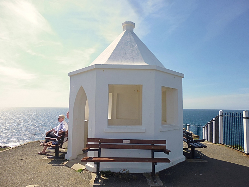
Entry Name: Coastguard's Lookout
Listing Date: 12 May 1988
Grade: II
Source: Historic England
Source ID: 1144135
English Heritage Legacy ID: 71105
ID on this website: 101144135
Location: Cornwall, TR7
County: Cornwall
Civil Parish: Newquay
Traditional County: Cornwall
Lieutenancy Area (Ceremonial County): Cornwall
Church of England Parish: Newquay
Church of England Diocese: Truro
Tagged with: Architectural structure
NEWQUAY
SW 76 SE
4/101 Coastguard's Lookout
- II
Coastguard's lookout hut. Early C20. Rendered, probably brick, with rendered roof.
Small octagonal lookout hut, with octagonal hipped roof with finial. The front has
pointed arched doorway, with 2 window openings on the 2 sides to right and left. The
3 rear sides have blind windows. All openings are unglazed. The hut is a prominent
landmark on the headland.
Listing NGR: SW7996062970
External links are from the relevant listing authority and, where applicable, Wikidata. Wikidata IDs may be related buildings as well as this specific building. If you want to add or update a link, you will need to do so by editing the Wikidata entry.


Other nearby listed buildings
