Approximate Location Map
Large Map »
Latitude: 54.5983 / 54°35'53"N
Longitude: -3.1361 / 3°8'9"W
OS Eastings: 326697
OS Northings: 523161
OS Grid: NY266231
Mapcode National: GBR 6HJ8.VF
Mapcode Global: WH706.SPT7
Plus Code: 9C6RHVX7+8H
Entry Name: 10-15, Borrowdale Road
Listing Date: 27 May 1977
Grade: II
Source: Historic England
Source ID: 1144691
English Heritage Legacy ID: 71767
ID on this website: 101144691
Location: Keswick, Cumberland, Cumbria, CA12
County: Cumbria
District: Allerdale
Civil Parish: Keswick
Built-Up Area: Keswick
Traditional County: Cumberland
Lieutenancy Area (Ceremonial County): Cumbria
Church of England Parish: Keswick St John
Church of England Diocese: Carlisle
Tagged with: Building
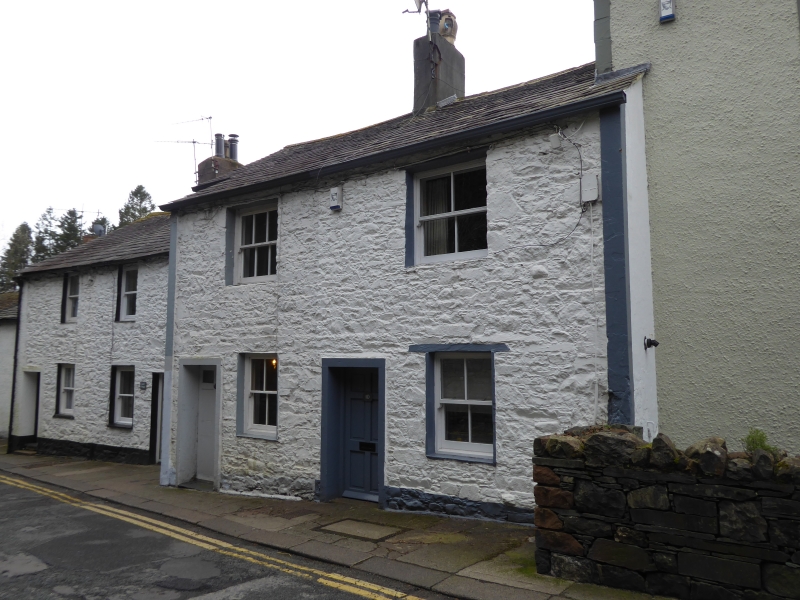
KESWICK BORROWDALE ROAD
1. ---------------
5161
Nos 10 to 15 (consec)
NY 2623 1/6
II GV
2.
Row of C18 stone rubble cottages in 3 steps up hill. Nos 14 and 15 are coloured
roughcast, Nos 10 to 12 are whitewashed. All are 2 storeys, with stone roofs.
Small sash windows (one on each floor to Nos 10 to 13, No 14 has 2 up, No 15 has
2 down).
Listing NGR: NY2669723161
External links are from the relevant listing authority and, where applicable, Wikidata. Wikidata IDs may be related buildings as well as this specific building. If you want to add or update a link, you will need to do so by editing the Wikidata entry.


Other nearby listed buildings
