Latitude: 51.0422 / 51°2'31"N
Longitude: -2.1052 / 2°6'18"W
OS Eastings: 392718
OS Northings: 126984
OS Grid: ST927269
Mapcode National: GBR 2YK.NKL
Mapcode Global: FRA 66GC.KMT
Plus Code: 9C3V2VRV+VW
Entry Name: Dairy in Temple Gardens to West of Wardour Castle
Listing Date: 6 July 1987
Grade: II
Source: Historic England
Source ID: 1146005
English Heritage Legacy ID: 321063
ID on this website: 101146005
Location: Wardour, Wiltshire, SP3
County: Wiltshire
Civil Parish: Tisbury
Traditional County: Wiltshire
Lieutenancy Area (Ceremonial County): Wiltshire
Church of England Parish: Tisbury St John the Baptist
Church of England Diocese: Salisbury
Tagged with: Dairy
TISBURY WARDOUR PARK ST 92 NW (north side)
4/273 Dairy in Temple Gardens to west of Wardour Castle
GV II
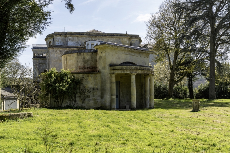
Ornamental dairy. Dated 1794 on rainwater head. Limestone ashlar with domed lead roof. Circular, with semi-circular west portico of four egg and dart unfluted columns, fluted frieze with paterae to Doric entablature, and parapet. Right return has lead rainwater head with date 1794. Rear has semi-circular projection to centre with oculus. Circular interior of portico has double 8-panelled doors and semi-circular niche either side. Interior not accessible at time of survey (January 1986), but said to have stone bench around walls, formerly lined with tiles, octagonal lantern to centre of domed roof. Part of the informal garden layout around Wardour Castle, the detail is very similar to the house and suggests that it may have been designed by Paine or by Soane who worked on the chapel, 1789-90.
Listing NGR: ST9271226986
External links are from the relevant listing authority and, where applicable, Wikidata. Wikidata IDs may be related buildings as well as this specific building. If you want to add or update a link, you will need to do so by editing the Wikidata entry.


Other nearby listed buildings