Latitude: 51.0423 / 51°2'32"N
Longitude: -2.1052 / 2°6'18"W
OS Eastings: 392723
OS Northings: 126997
OS Grid: ST927269
Mapcode National: GBR 2YK.NKK
Mapcode Global: FRA 66GC.KNV
Plus Code: 9C3V2VRV+WW
Entry Name: Hexagonal Annexe to West of Wardour Castle
Listing Date: 6 January 1966
Grade: II
Source: Historic England
Source ID: 1184577
English Heritage Legacy ID: 321066
ID on this website: 101184577
Location: Wardour, Wiltshire, SP3
County: Wiltshire
Civil Parish: Tisbury
Traditional County: Wiltshire
Lieutenancy Area (Ceremonial County): Wiltshire
Church of England Parish: Tisbury St John the Baptist
Church of England Diocese: Salisbury
Tagged with: Architectural structure
TISBURY WARDOUR PARK ST 92 NW (north side)
4/276 Hexagonal annexe to west of Wardour Castle 6.1.66 GV II
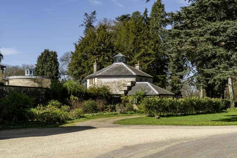
Service outhouse, now annexe to Cranborne Chase School. Early C19, converted to dwelling late C19. Limestone ashlar, Welsh slate roof, ashlar stacks. Hexagonal. Two-storey, 2-window. Single- storey late C19 extension to north with attached C20 extension and porch. West side has two 2-light chamfered mullioned casements to ground floor and one to first floor. South and south-east sides have blocked round-arched openings, south side has 3-light chamfered mullioned casement to ground and first floor. Hexagonal leaded vent to apex of roof. Interior not inspected. Reputed to have been a brewhouse, built in corner of courtyard to west of the Chapel (q.v.), adjacent to the Dairy (q.v.).
Listing NGR: ST9272026996
External links are from the relevant listing authority and, where applicable, Wikidata. Wikidata IDs may be related buildings as well as this specific building. If you want to add or update a link, you will need to do so by editing the Wikidata entry.


Other nearby listed buildings