Latitude: 54.2993 / 54°17'57"N
Longitude: -0.8901 / 0°53'24"W
OS Eastings: 472331
OS Northings: 489868
OS Grid: SE723898
Mapcode National: GBR QL7Q.3L
Mapcode Global: WHF9N.96DD
Plus Code: 9C6X74X5+PX
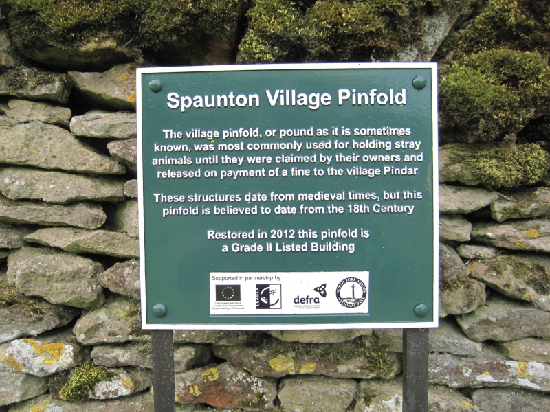
Entry Name: Pound
Listing Date: 24 June 1987
Grade: II
Source: Historic England
Source ID: 1149031
English Heritage Legacy ID: 328946
ID on this website: 101149031
Location: Spaunton, North Yorkshire, YO62
County: North Yorkshire
District: Ryedale
Civil Parish: Spaunton
Traditional County: Yorkshire
Lieutenancy Area (Ceremonial County): North Yorkshire
Church of England Parish: Lastingham St Mary
Church of England Diocese: York
Tagged with: Animal pound
SPAUNTON HALL INGS LANE
NORTH YORKSHIRE
RYEDALE
5340
SE 78 NW
(south side)
10/108 Pound
- II
Village pound. Probably C18. Rubble gritstone. Square on plan. Walls
approximately 1.2 to 1.5 metres high with diagonally laid coping stones.
Gateway in south-east corner.
Listing NGR: SE7233189868
External links are from the relevant listing authority and, where applicable, Wikidata. Wikidata IDs may be related buildings as well as this specific building. If you want to add or update a link, you will need to do so by editing the Wikidata entry.


Other nearby listed buildings