Latitude: 54.2703 / 54°16'12"N
Longitude: -0.9317 / 0°55'53"W
OS Eastings: 469672
OS Northings: 486595
OS Grid: SE696865
Mapcode National: GBR PMY1.3Z
Mapcode Global: WHF9M.NXKQ
Plus Code: 9C6X73C9+48
Entry Name: No 12 with Attached Outbuilding to Rear
Listing Date: 5 June 1985
Grade: II
Source: Historic England
Source ID: 1149230
English Heritage Legacy ID: 328394
ID on this website: 101149230
Location: Kirkbymoorside, North Yorkshire, YO62
County: North Yorkshire
District: Ryedale
Town: Ryedale
Civil Parish: Kirkbymoorside
Built-Up Area: Kirkbymoorside
Traditional County: Yorkshire
Lieutenancy Area (Ceremonial County): North Yorkshire
Church of England Parish: Kirkbymoorside All Saints
Church of England Diocese: York
Tagged with: Building
SE 6886-6986
6/36
KIRKBYMOORSIDE
CROWN SQUARE
(west side)
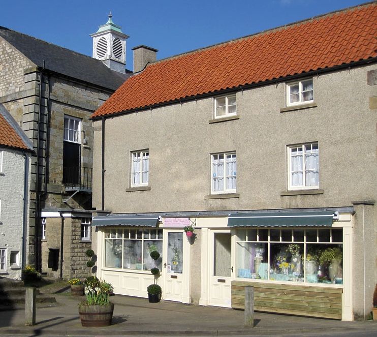
No 12 with attached outbuilding to rear
GV
II
House, extending into former stables and fire-engine house. C17 with C18
and C19 alteration. Timber framed upper storey now encased in sandstone and
rendered to front and rear; coursed sandstone right gable wall; brick and
pebble dash left gable wall. Pantile roof; brick stacks. 2½-storey,
3-window front. Irregular quoins. Ground floor is occupied by former
garage premises, now used for storage, closed by sliding doors hung in a
projecting concrete frame. Present entrance is through the rear. The first
and attic floor windows are 2-light horizontal sliding sashes. Between
first floor windows to right is datestone inscribed: ' A IE ' 1724.
Coped right gable wall with kneeler. To left, the gable end is jettied on quarter-round
moulded beams with wooden pegs. At rear, the attic storey is also jettied.
Listing NGR: SE6967286595
External links are from the relevant listing authority and, where applicable, Wikidata. Wikidata IDs may be related buildings as well as this specific building. If you want to add or update a link, you will need to do so by editing the Wikidata entry.


Other nearby listed buildings