Latitude: 54.2193 / 54°13'9"N
Longitude: -1.2908 / 1°17'26"W
OS Eastings: 446339
OS Northings: 480631
OS Grid: SE463806
Mapcode National: GBR MMFN.B7
Mapcode Global: WHD8Q.46LQ
Plus Code: 9C6W6P95+PM
Entry Name: Church of St Mary
Listing Date: 15 June 1984
Grade: II
Source: Historic England
Source ID: 1151336
English Heritage Legacy ID: 333240
Also known as: St Mary's Church, Bagby
ID on this website: 101151336
Location: St Mary's Church, Bagby, North Yorkshire, YO7
County: North Yorkshire
District: Hambleton
Civil Parish: Bagby
Built-Up Area: Bagby
Traditional County: Yorkshire
Lieutenancy Area (Ceremonial County): North Yorkshire
Tagged with: Church building
SE 48 SE BAGBY BACK LANE 3/1 (south side)
Church of St Mary
II
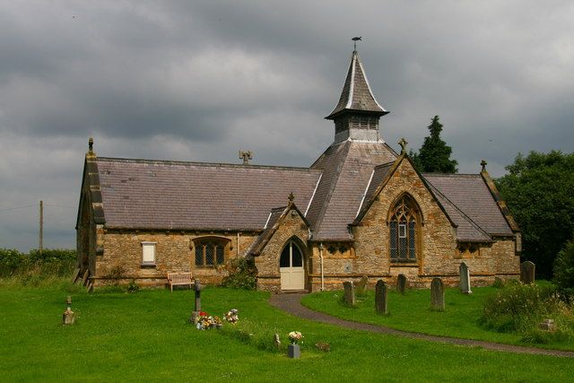
Church. 1862. E B Lamb. Stone. Slate roof. Cruciform but with centralised emphasis created by the spacious crossing which incorporates the short transepts and is of greater width than the aisleless nave and tiny chancel. South porch. The exterior is dominated by the complex roof arrangements:- the pyramidal roof of the crossing, starting at a lower level to accommodate the wider span, is cut by the transepts rising through it and truncated by a turret with spirelet. Interior:- wooden roof to nave and chancel with transverse arches on stone corbels, collars and purlins. Complex crossing roof structure of intersecting arches, leaving room only for pairs of tiny quatrefoil lights set into each corner of the crossing. The other windows are 3-light with trefoil heads and simple tracery under pointed arches with the exception of the low flat-arched nave windows.
Listing NGR: SE4633980631
External links are from the relevant listing authority and, where applicable, Wikidata. Wikidata IDs may be related buildings as well as this specific building. If you want to add or update a link, you will need to do so by editing the Wikidata entry.


Other nearby listed buildings