Approximate Location Map
Large Map »
Latitude: 54.2189 / 54°13'7"N
Longitude: -1.2881 / 1°17'17"W
OS Eastings: 446518
OS Northings: 480581
OS Grid: SE465805
Mapcode National: GBR MMFN.XF
Mapcode Global: WHD8Q.57W3
Plus Code: 9C6W6P96+GQ
Entry Name: East Farmhouse
Listing Date: 15 June 1984
Grade: II
Source: Historic England
Source ID: 1151339
English Heritage Legacy ID: 333245
ID on this website: 101151339
Location: Bagby, North Yorkshire, YO7
County: North Yorkshire
District: Hambleton
Civil Parish: Bagby
Built-Up Area: Bagby
Traditional County: Yorkshire
Lieutenancy Area (Ceremonial County): North Yorkshire
Tagged with: Farmhouse
SE 48 SE BAGBY BAGBY LANE
3/6 (north side)
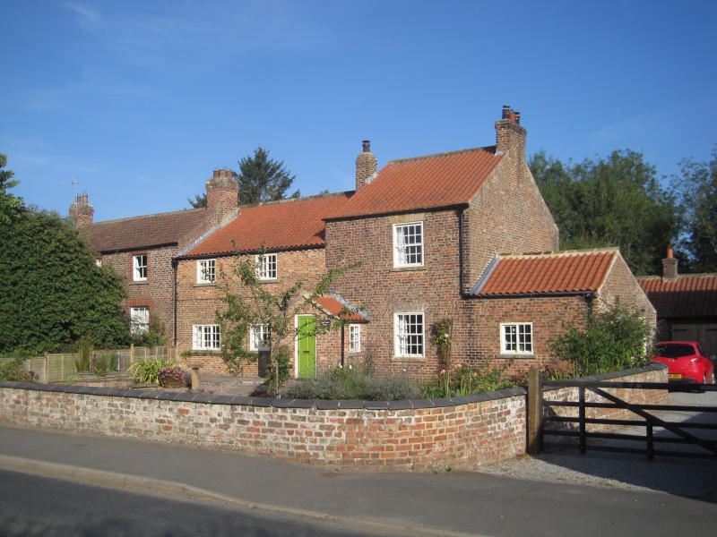
East Farmhouse
II
House of 2 buildings. C18 and C19. The C18 section to the left is of reddish-brown
brick with 1st floor bond. Pantile roof. 2 storeys, the upper storey being very low
2 bays. Entrance originally to right, now blocked. Horizontally sliding sashes with
glazing bars, flat brick arches to ground floor windows. The taller, C19 section is
brown brick. Pantile roof. 2 storeys with lower windowless wing to right. 1 bay.
Entrance to left. Panelled door with oblong fanlight and simple wooden case, sashes
with margin lights.
Listing NGR: SE4651880581
External links are from the relevant listing authority and, where applicable, Wikidata. Wikidata IDs may be related buildings as well as this specific building. If you want to add or update a link, you will need to do so by editing the Wikidata entry.


Other nearby listed buildings
