Approximate Location Map
Large Map »
Latitude: 51.4798 / 51°28'47"N
Longitude: -0.8524 / 0°51'8"W
OS Eastings: 479793
OS Northings: 176268
OS Grid: SU797762
Mapcode National: GBR C5M.1BV
Mapcode Global: VHDWW.52RG
Plus Code: 9C3XF4HX+W3
Entry Name: Cole Tomb, 14 Metres South of Tower of Church of St James
Listing Date: 23 December 1983
Grade: II
Source: Historic England
Source ID: 1154631
English Heritage Legacy ID: 41295
ID on this website: 101154631
Location: St James's Church, Ruscombe, Wokingham, Berkshire, RG10
County: Wokingham
Civil Parish: Ruscombe
Traditional County: Berkshire
Lieutenancy Area (Ceremonial County): Berkshire
Church of England Parish: Ruscombe and Twyford
Church of England Diocese: Oxford
Tagged with: Architectural structure
RUSCOMBE CHURCH LANE
SU 77 NE
(west side)
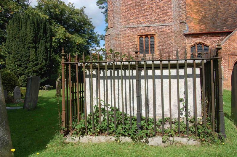
2/13 Cole tomb, 14
metres south of
Tower of Church of
St. James
G.V. II
Chest tomb. 1816. Stone, moulded top, plain plinth, recessed side and
end. Inscription panels, with high palisade of spear topped railings.
Listing NGR: SU7979376268
External links are from the relevant listing authority and, where applicable, Wikidata. Wikidata IDs may be related buildings as well as this specific building. If you want to add or update a link, you will need to do so by editing the Wikidata entry.


Other nearby listed buildings
