Approximate Location Map
Large Map »
Latitude: 51.4121 / 51°24'43"N
Longitude: -1.1515 / 1°9'5"W
OS Eastings: 459106
OS Northings: 168463
OS Grid: SU591684
Mapcode National: GBR 93B.HNY
Mapcode Global: VHCZG.0R3V
Plus Code: 9C3WCR6X+R9
Entry Name: Bigg Tomb Approximately 33 Metres to South East of Chancel of Church of St Mary
Listing Date: 10 November 1983
Grade: II
Source: Historic England
Source ID: 1155122
English Heritage Legacy ID: 39544
ID on this website: 101155122
Location: St Mary's Church, Beenham, West Berkshire, RG7
County: West Berkshire
Civil Parish: Beenham
Built-Up Area: Beenham
Traditional County: Berkshire
Lieutenancy Area (Ceremonial County): Berkshire
Church of England Parish: Beenham Valence
Church of England Diocese: Oxford
Tagged with: Tomb
BEENHAM
SU 56NE
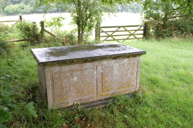
3/40 Bigg Tomb Approximately
33 Metres To South East
Of Chancel Of Church Of
St.Mary
GV II
Chest tomb. C18. Ashlar. Rectangular with moulded top and base, and panelled sides
with some armorial carving.
Listing NGR: SU5910668463
External links are from the relevant listing authority and, where applicable, Wikidata. Wikidata IDs may be related buildings as well as this specific building. If you want to add or update a link, you will need to do so by editing the Wikidata entry.


Other nearby listed buildings
