Latitude: 51.248 / 51°14'52"N
Longitude: -0.7658 / 0°45'56"W
OS Eastings: 486239
OS Northings: 150591
OS Grid: SU862505
Mapcode National: GBR D9R.R63
Mapcode Global: VHDXW.PW0P
Plus Code: 9C3X66XM+5M
Entry Name: Culdrose House
Listing Date: 9 June 1982
Grade: II
Source: Historic England
Source ID: 1155936
English Heritage Legacy ID: 137853
ID on this website: 101155936
Location: Aldershot, Rushmoor, Hampshire, GU11
County: Hampshire
District: Rushmoor
Electoral Ward/Division: Manor Park
Parish: Non Civil Parish
Built-Up Area: Aldershot
Traditional County: Hampshire
Lieutenancy Area (Ceremonial County): Hampshire
Church of England Parish: Aldershot Holy Trinity
Church of England Diocese: Guildford
Tagged with: House
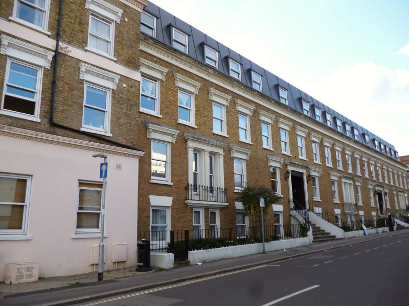
FREDERICK STREET 1. 5238 Aldershot Culdrose House SU 8650 5/29 II 2. Late C19 reconstructed behind, slightly altered facade 1981. A comparatively early terrace in the rapidly growing town. 2 storeys above semi-basement; each unit has 2 windows above 1 window. Despite a slight fall of ground the slate roof continues unstepped. Yellow brick walling in Flemish bond, stucco features. Parapet has a fully-moulded dentil cornice, window openings have a moulded cornice on ornamental brackets, doorways are coupled within a simple Order, having pilasters now conveted to windows with balconettes. Roof not visible. Cast-iron railings along street front and to single entrance steps. The modern block built behind the facade is not of special interest.
Listing NGR: SU8624050575
External links are from the relevant listing authority and, where applicable, Wikidata. Wikidata IDs may be related buildings as well as this specific building. If you want to add or update a link, you will need to do so by editing the Wikidata entry.


Other nearby listed buildings