Approximate Location Map
Large Map »
Latitude: 51.3538 / 51°21'13"N
Longitude: -1.3219 / 1°19'18"W
OS Eastings: 447313
OS Northings: 161849
OS Grid: SU473618
Mapcode National: GBR 82K.2M0
Mapcode Global: VHCZR.17HK
Plus Code: 9C3W9M3H+G6
Entry Name: Oxdrove House
Listing Date: 18 May 1984
Grade: II
Source: Historic England
Source ID: 1157554
English Heritage Legacy ID: 138047
ID on this website: 101157554
Location: Earlstone Common, Basingstoke and Deane, Hampshire, RG20
County: Hampshire
District: Basingstoke and Deane
Civil Parish: Burghclere
Traditional County: Hampshire
Lieutenancy Area (Ceremonial County): Hampshire
Church of England Parish: Burghclere with Newtown
Church of England Diocese: Winchester
Tagged with: House
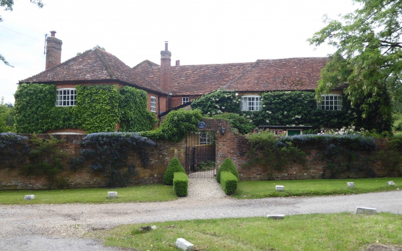
SU 46 SE BURGHCLERE OX DROVE
2/19
Oxdrove House
II
C18, C20. Front (north) of 2 storeys, 2 windows. Hipped tile roof, brick dentil
eaves. Red brick walling in Flemish bond with blue headers, cambered openings.
Casements. Modern porch. Large modern extensions, in matching style.
Listing NGR: SU4731161847
External links are from the relevant listing authority and, where applicable, Wikidata. Wikidata IDs may be related buildings as well as this specific building. If you want to add or update a link, you will need to do so by editing the Wikidata entry.


Other nearby listed buildings
