Latitude: 51.9081 / 51°54'29"N
Longitude: -0.5991 / 0°35'56"W
OS Eastings: 496468
OS Northings: 224215
OS Grid: SP964242
Mapcode National: GBR F3C.CCR
Mapcode Global: VHFRB.K9NK
Plus Code: 9C3XWC52+79
Entry Name: Hill Farmhouse
Listing Date: 26 September 1980
Grade: II
Source: Historic England
Source ID: 1159194
English Heritage Legacy ID: 36070
ID on this website: 101159194
Location: Stanbridge, Central Bedfordshire, LU7
County: Central Bedfordshire
Civil Parish: Stanbridge
Built-Up Area: Stanbridge
Traditional County: Bedfordshire
Lieutenancy Area (Ceremonial County): Bedfordshire
Church of England Parish: Stanbridge
Church of England Diocese: St.Albans
Tagged with: Farmhouse
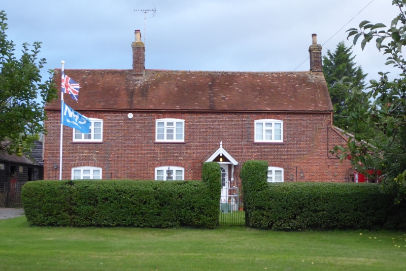
1.
5125 STANBRIDGE TILSWORTH ROAD
(north side)
Hill Farmhouse
SF 9624 26/270
II
2.
C18. Red stretchers and grey headers. Two storeys. Old clay tile roof. Three
casement windows. C19 bracketed gabled doorhood.
Listing NGR: SP9646824215
External links are from the relevant listing authority and, where applicable, Wikidata. Wikidata IDs may be related buildings as well as this specific building. If you want to add or update a link, you will need to do so by editing the Wikidata entry.


Other nearby listed buildings