Latitude: 54.7251 / 54°43'30"N
Longitude: -1.5645 / 1°33'52"W
OS Eastings: 428147
OS Northings: 536769
OS Grid: NZ281367
Mapcode National: GBR KFJS.2Y
Mapcode Global: WHC4X.YH5H
Plus Code: 9C6WPCGP+36
Entry Name: High Grange Farmhouse and Attached Farmbuildings
Listing Date: 7 December 1987
Grade: II
Source: Historic England
Source ID: 1159310
English Heritage Legacy ID: 109954
ID on this website: 101159310
Location: Hett, County Durham, DH6
County: County Durham
Civil Parish: Croxdale and Hett
Traditional County: Durham
Lieutenancy Area (Ceremonial County): County Durham
Church of England Parish: Croxdale
Church of England Diocese: Durham
Tagged with: Farmhouse
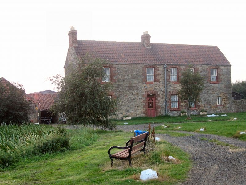
CROXDALE AND HETT WEST STREET NZ 23 NE (West side) Hett Village 6/73 High Grange Farmhouse and attached farmbuildings GV II Farmhouse and adjoining farmbuildings. Probably early C18 farmhouse extended in C19; late C18-early C19 farmbuildings. Farmhouse: coursed and partly- squared sandstone rubble with late C19 brick dressings; French-tiled roof and rebuilt brick chimney stacks. Coursed rubble farmbuildings with corrugated- asbestos and pantiled roofs. U-plan range of farmbuildings on right rear of house. 2-storey farmhouse of 2 builds. 3-bay original section to right of staggered straight joint; added 3-bay section at left. Tooled stone quoins at right and engineering brick quoins at left. Late C20 door and overlight to left of joint. Doorway and 6-pane sashes in late C19 openings with brick jambs and segmental heads. Blocked windows in second bay from left. Horizontal- sliding sash at ground-floor right in C18 opening with tooled stone jambs and extended sill and lintel. Left end and ridge stacks. Single-storey, 2-bay wing with altered openings on right rear. Altered single-storey farmbuildings: 2-bay shed with C20 garage opening on rear of wing; taller 3-bay barn, with steeply-pitched roof and reverse- stepped gables, on rear of shed; L-plan range of loose-boxes/byres, with Dutch doors and hipped pantiled roofs, to left of barn. Farmbuildings included for group value.
Listing NGR: NZ2814736769
External links are from the relevant listing authority and, where applicable, Wikidata. Wikidata IDs may be related buildings as well as this specific building. If you want to add or update a link, you will need to do so by editing the Wikidata entry.


Other nearby listed buildings