Latitude: 51.5681 / 51°34'5"N
Longitude: -0.7689 / 0°46'8"W
OS Eastings: 485421
OS Northings: 186192
OS Grid: SU854861
Mapcode National: GBR D5W.QDC
Mapcode Global: VHDWB.MVC7
Plus Code: 9C3XH69J+7C
Entry Name: Weir Cottage
Listing Date: 31 January 1974
Grade: II
Source: Historic England
Source ID: 1159631
English Heritage Legacy ID: 46243
ID on this website: 101159631
Location: Marlow, Buckinghamshire, SL7
County: Buckinghamshire
Civil Parish: Marlow
Built-Up Area: Marlow
Traditional County: Buckinghamshire
Lieutenancy Area (Ceremonial County): Buckinghamshire
Church of England Parish: Great Marlow with Marlow Bottom, Little Marlow and Bisham
Church of England Diocese: Oxford
Tagged with: Cottage
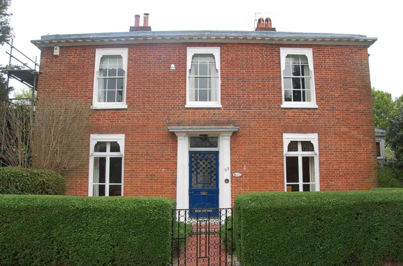
MILL ROAD
1.
1585
No 33
(Weir Cottage)
SU 8586 1/118
II
2.
C18 slightly altered in C19, facing River Thames. 2 storeys, 3 windows,
red brick. Glazing bars. Ground floor has french windows, and central
door in plain architrave. Dentil Eaves cornice. Hipped slate roof.
Listing NGR: SU8542186192
External links are from the relevant listing authority and, where applicable, Wikidata. Wikidata IDs may be related buildings as well as this specific building. If you want to add or update a link, you will need to do so by editing the Wikidata entry.


Other nearby listed buildings