Latitude: 53.6795 / 53°40'46"N
Longitude: -0.7238 / 0°43'25"W
OS Eastings: 484395
OS Northings: 421094
OS Grid: SE843210
Mapcode National: GBR RTDW.3Q
Mapcode Global: WHFDM.VSJ2
Plus Code: 9C5XM7HG+RF
Entry Name: Barn Approximately 30 Metres North West of East View Farmhouse
Listing Date: 30 September 1987
Grade: II
Source: Historic England
Source ID: 1162290
English Heritage Legacy ID: 165434
ID on this website: 101162290
Location: Adlingfleet, East Riding of Yorkshire, DN14
County: East Riding of Yorkshire
Civil Parish: Twin Rivers
Traditional County: Yorkshire
Lieutenancy Area (Ceremonial County): East Riding of Yorkshire
Church of England Parish: Adlingfleet All Saints
Church of England Diocese: Sheffield
Tagged with: Barn
SE 82 SW TWIN RIVERS MANOR ROAD (north side) Adlingfleet 1/46 Barn approximately 30 metres north-west of East View Farmhouse
GV II
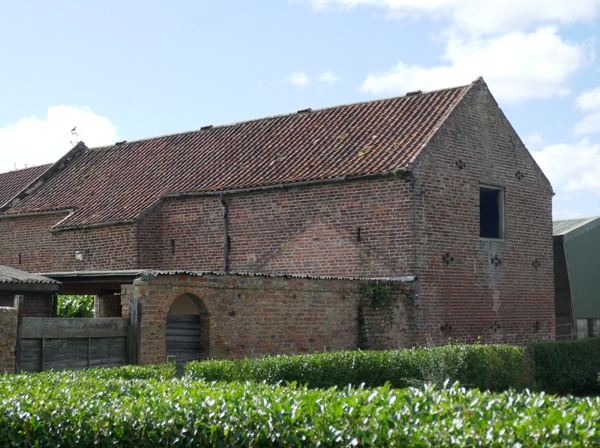
Threshing barn. Mid-late C18. Brown brick with pantile roof. Rectangular on plan. Forms north-west side of foldyard. Barn: 2-storey height, 4 internal bays. West side has projecting waggon entrance to right of centre with pair of harr-hung board doors containing wicket, beneath timber lintel. Side bays have 2 rows of breather slits, the top row shorter: 4 to left, 2 to right. Stepped eaves. Tumbled-in brick to raised gables. East side: projecting bay has lower waggon entrance with inserted doors beneath timber lintel and segmental relieving arch. Side bays have similar arrangement of breather slits to west side, but with board door to far left. Far right partly obscured by adjoining range which is not of special interest. North gable end: pair of cross-shaped breathers below, single central breather slit above, central board door above flanked by pair of cross-shaped breathers. South gable end has internal connecting door at first-floor level to adjoining stable/granary, and owl-hole to gable. Interior has king-post roof with raking struts to kerbed principals carrying single bracketed through-purlins.
Listing NGR: SE8439521094
External links are from the relevant listing authority and, where applicable, Wikidata. Wikidata IDs may be related buildings as well as this specific building. If you want to add or update a link, you will need to do so by editing the Wikidata entry.


Other nearby listed buildings