Latitude: 52.1908 / 52°11'26"N
Longitude: -0.0627 / 0°3'45"W
OS Eastings: 532526
OS Northings: 256492
OS Grid: TL325564
Mapcode National: GBR K5X.NYV
Mapcode Global: VHGMQ.V6QD
Plus Code: 9C4X5WRP+8W
Entry Name: Outbuildings to Number 21
Listing Date: 31 May 1985
Grade: II
Source: Historic England
Source ID: 1162600
English Heritage Legacy ID: 51067
ID on this website: 101162600
Location: Bourn, South Cambridgeshire, CB23
County: Cambridgeshire
District: South Cambridgeshire
Civil Parish: Bourn
Built-Up Area: Bourn
Traditional County: Cambridgeshire
Lieutenancy Area (Ceremonial County): Cambridgeshire
Church of England Parish: Bourn St Helena and St Mary
Church of England Diocese: Ely
Tagged with: Appendage Thatched building
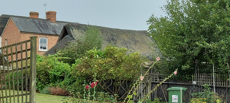
TL 3256-3356 BOURN HIGH STREET
(North-East Side)
15/173 Outbuildings to
No. 21
GV II
Outbuildings. Possibly C18 or later. Timber-framed and weatherboarded.
Thatched roofs. L-plan with gable outshut to right hand. Three double
boarded doors. Included for group value.
Listing NGR: TL3252656492
External links are from the relevant listing authority and, where applicable, Wikidata. Wikidata IDs may be related buildings as well as this specific building. If you want to add or update a link, you will need to do so by editing the Wikidata entry.


Other nearby listed buildings