Latitude: 52.2795 / 52°16'46"N
Longitude: -2.7794 / 2°46'45"W
OS Eastings: 346920
OS Northings: 264876
OS Grid: SO469648
Mapcode National: GBR BH.YGDT
Mapcode Global: VH770.RYZY
Plus Code: 9C4V76HC+Q6
Entry Name: Vicarage Farmhouse
Listing Date: 11 June 1959
Grade: II
Source: Historic England
Source ID: 1167719
English Heritage Legacy ID: 150167
ID on this website: 101167719
Location: Yarpole, County of Herefordshire, HR6
County: County of Herefordshire
Civil Parish: Croft and Yarpole
Built-Up Area: Yarpole
Traditional County: Herefordshire
Lieutenancy Area (Ceremonial County): Herefordshire
Church of England Parish: Croft with Yarpole and Lucton
Church of England Diocese: Hereford
Tagged with: Farmhouse
YARPOLE CP GREEN LANE (north side) SO 46 SE 6/144 Vicarage Farmhouse 11.6.59
GV II
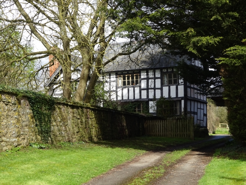
Farmhouse. C16, extended C17, with some mid-C19 alterations and mid-C20 repairs. Timber-frame with painted brick infill on a coursed rubble plinth with slate roof. L-plan, C16 wing to north, C17 range to east. Lateral stack on west wall of north wing of rubble with dressed quoins, and two brick shafts of six-point star plan. Another lateral stack on north wall of east wing. South front of two storeys with gabled cross- wing to left. One plus two windows, top-hung casement to left, then a 3-light and a 2-light casement. Ground floor has 3-light casements. Entrance to left of east wing has a C20 ledged and boarded door in a wooden architrave. Framing of cross-wing four square panels high with curved angle braces, the gable-end truss has two struts to the collar. Other range, five rectangular panels high, the east gable truss has two collars, multiple struts and two curved struts in apex. Interior exposed chamfered and stopped ceiling beams. (RCHM, 3, p 216, no 8).
Listing NGR: SO4692064876
External links are from the relevant listing authority and, where applicable, Wikidata. Wikidata IDs may be related buildings as well as this specific building. If you want to add or update a link, you will need to do so by editing the Wikidata entry.


Other nearby listed buildings