Approximate Location Map
Large Map »
Latitude: 52.3228 / 52°19'22"N
Longitude: -2.0069 / 2°0'24"W
OS Eastings: 399624
OS Northings: 269416
OS Grid: SO996694
Mapcode National: GBR 2G6.9G0
Mapcode Global: VH9ZM.5WC5
Plus Code: 9C4V8XFV+46
Entry Name: Plymouth House
Listing Date: 16 July 1986
Grade: II
Source: Historic England
Source ID: 1167883
English Heritage Legacy ID: 156200
ID on this website: 101167883
Location: Tardebigge, Bromsgrove, Worcestershire, B60
County: Worcestershire
District: Bromsgrove
Civil Parish: Tutnall and Cobley
Traditional County: Worcestershire
Lieutenancy Area (Ceremonial County): Worcestershire
Church of England Parish: Tardebigge
Church of England Diocese: Worcester
Tagged with: House
SO 96 NE TUTNALL & COBLEY CP ALCESTER ROAD (north side)
Tardebigge
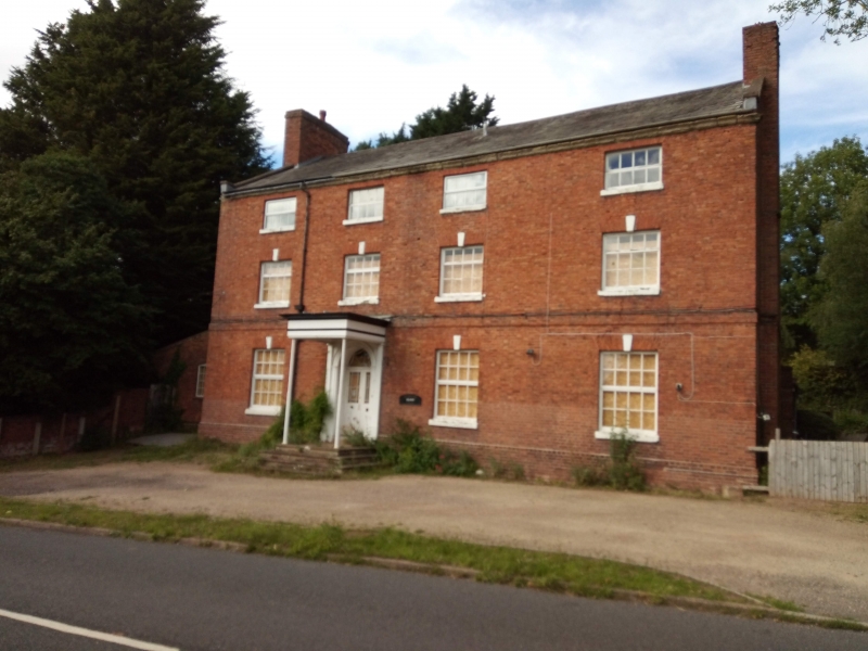
9/149 Plymouth House
- II
House. Late C18 with some late C20 alterations. Brick with slate roof
and gable-end stacks. Three storeys, moulded stone cornice, band to ground
floor; four windows: top-hung C20 casements under rubbed brick heads with key-
stones; second floor: windows of small proportion; ground floor: entrance to
left of centre has a flat canopy with moulded cornice on two slender cast iron
columns; pilastered doorcase with radially glazed fanlight; 2-leaf half-glazed
door.
Listing NGR: SO9962469416
External links are from the relevant listing authority and, where applicable, Wikidata. Wikidata IDs may be related buildings as well as this specific building. If you want to add or update a link, you will need to do so by editing the Wikidata entry.


Other nearby listed buildings
