Approximate Location Map
Large Map »
Latitude: 52.3201 / 52°19'12"N
Longitude: -2.0079 / 2°0'28"W
OS Eastings: 399560
OS Northings: 269115
OS Grid: SO995691
Mapcode National: GBR 2G6.H66
Mapcode Global: VH9ZM.4YW8
Plus Code: 9C4V8XCR+3V
Entry Name: Churchyard Cross About 15 Metres South of Church of St Bartholomew
Listing Date: 16 July 1986
Grade: II
Source: Historic England
Source ID: 1348585
English Heritage Legacy ID: 156225
ID on this website: 101348585
Location: St Bartholomew's Church, Tardebigge, Bromsgrove, Worcestershire, B60
County: Worcestershire
District: Bromsgrove
Civil Parish: Tutnall and Cobley
Traditional County: Worcestershire
Lieutenancy Area (Ceremonial County): Worcestershire
Church of England Parish: Tardebigge
Church of England Diocese: Worcester
Tagged with: Churchyard cross
SO 96 NE TUTNALL & COBLEY CP HIGH HOUSE LANE (off north side)
Tardebigge
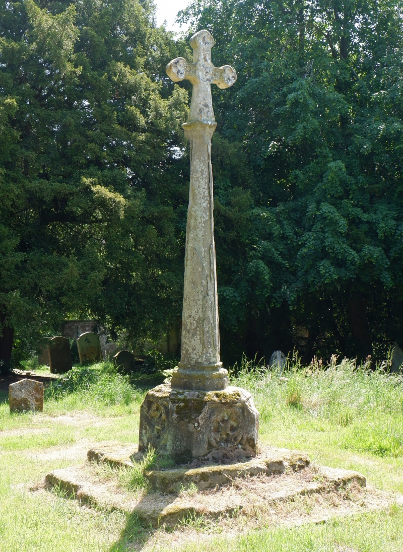
9/173 Churchyard cross about
15 metres south of
Church of St Bartholomew
GV II
Churchyard cross. Probably C15 with some mid-C19 restoration. Ashlar.
Three square-plan steps leading up to square block which has a quatrefoil
on each side with shield; C19 octagonal shaft and cross.
Listing NGR: SO9956069115
External links are from the relevant listing authority and, where applicable, Wikidata. Wikidata IDs may be related buildings as well as this specific building. If you want to add or update a link, you will need to do so by editing the Wikidata entry.


Other nearby listed buildings
