Latitude: 53.273 / 53°16'22"N
Longitude: 0.1038 / 0°6'13"E
OS Eastings: 540383
OS Northings: 377175
OS Grid: TF403771
Mapcode National: GBR YZ5L.8F
Mapcode Global: WHJLC.KZMR
Plus Code: 9F5274F3+5G
Entry Name: Limepits Farmhouse
Listing Date: 29 July 1987
Grade: II
Source: Historic England
Source ID: 1168732
English Heritage Legacy ID: 196100
ID on this website: 101168732
Location: South Thoresby, East Lindsey, Lincolnshire, LN13
County: Lincolnshire
District: East Lindsey
Civil Parish: South Thoresby
Traditional County: Lincolnshire
Lieutenancy Area (Ceremonial County): Lincolnshire
Church of England Parish: Strubby Wold Marsh St Oswald
Church of England Diocese: Lincoln
Tagged with: Farmhouse
SOUTH THORESBY BELLAU ROAD TF 47 NW (west side) 2/34 Limepits Farmhouse
II
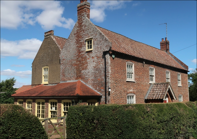
Farmhouse. Late C18, altered late C19. Red brick in Flemish bond, pantile roof with raised brick coped tumbled gables with 2 gable stacks. Parallel ranges plan. 2 storey, plus garret, 4 bay front having brick dentillated eaves course. Off centre door covered by C19 gabled porch having semi-circular headed outer door with plain fanlight and semi-circular headed sidelights, to left a single and to right 2 glazing bar sashes. To first floor are 4 glazing bar sashes. All windows have segmental brick heads.
Listing NGR: TF4038377175
External links are from the relevant listing authority and, where applicable, Wikidata. Wikidata IDs may be related buildings as well as this specific building. If you want to add or update a link, you will need to do so by editing the Wikidata entry.


Other nearby listed buildings