Latitude: 50.8356 / 50°50'7"N
Longitude: -2.9847 / 2°59'5"W
OS Eastings: 330752
OS Northings: 104464
OS Grid: ST307044
Mapcode National: GBR M6.WMN9
Mapcode Global: FRA 46MW.R05
Plus Code: 9C2VR2P8+64
Entry Name: Hooper's Farmhouse
Listing Date: 19 October 1984
Grade: II
Source: Historic England
Source ID: 1169931
English Heritage Legacy ID: 87792
ID on this website: 101169931
Location: Chardstock, East Devon, EX13
County: Devon
District: East Devon
Civil Parish: Chardstock
Built-Up Area: Chardstock
Traditional County: Dorset
Lieutenancy Area (Ceremonial County): Devon
Church of England Parish: Chardstock St Andrew
Church of England Diocese: Exeter
Tagged with: Farmhouse Thatched farmhouse
ST 3004 CHARDSTOCK MILL HILL 19/106 CHARDSTOCK
Hooper's Farmhouse GV II
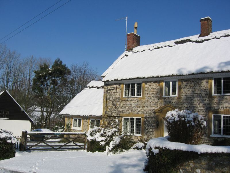
Farmhouse. Circa early C18. Knapped flint with stone dressings. Thatched roof with stone coping to gable ends and dentilled eaves cornice. Two storeys. Long four window range. C18 three light casements with leaded panes in plain stone architraves with keystones. Stone doorway to left of centre with pilasters, broken pediment and modern panelled door. Brick ridge chimney stack and end stacks. Modern single storey stone wings at either end.
Listing NGR: ST3075204464
External links are from the relevant listing authority and, where applicable, Wikidata. Wikidata IDs may be related buildings as well as this specific building. If you want to add or update a link, you will need to do so by editing the Wikidata entry.


Other nearby listed buildings