Latitude: 51.2488 / 51°14'55"N
Longitude: -2.8401 / 2°50'24"W
OS Eastings: 341461
OS Northings: 150296
OS Grid: ST414502
Mapcode National: GBR MD.1N8T
Mapcode Global: VH7D0.QWF1
Plus Code: 9C3V65X5+GX
Entry Name: Ashton Windmill
Listing Date: 30 August 1972
Grade: II*
Source: Historic England
Source ID: 1173522
English Heritage Legacy ID: 268760
ID on this website: 101173522
Location: Ashton, Somerset, BS28
County: Somerset
District: Sedgemoor
Civil Parish: Chapel Allerton
Traditional County: Somerset
Lieutenancy Area (Ceremonial County): Somerset
Tagged with: Windmill
ST45SW CHAPEL ALLERTON CP
ASHTON
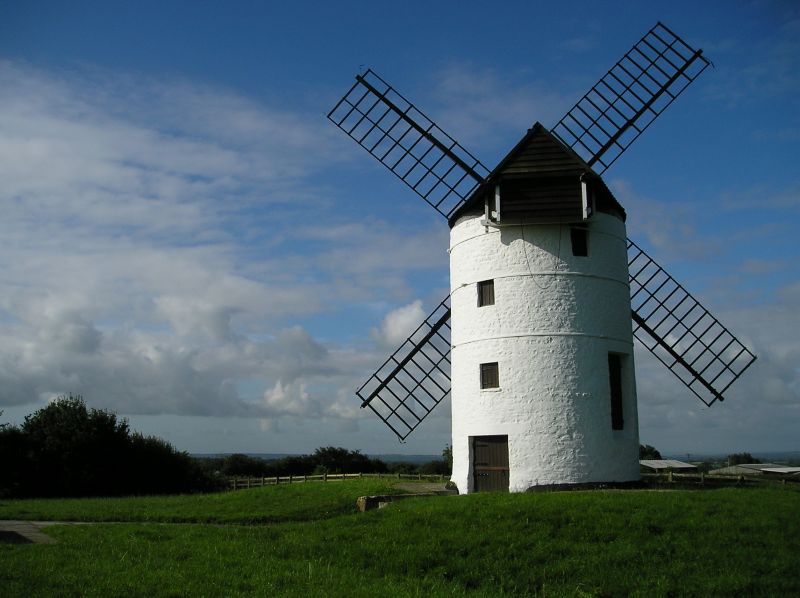
5/104 Ashton Windmill
30.8.72
- II*
Windmill. Of medieval establishment, present structure probably C18, restored 1967. Tower mill. Coursed colourwashed
rubble tower, circular on plan; revolving cap with contoured weatherboarded roof, tailfan 4 sails. Plank door to
"ground" floor, 2 further plank doors to "first" floor, 4 small windows with board infills: 3 iron ties around tower.
Interior with corn grinding mechanism. (PSANHS Vol XLV p 39).
Listing NGR: ST4146150296
External links are from the relevant listing authority and, where applicable, Wikidata. Wikidata IDs may be related buildings as well as this specific building. If you want to add or update a link, you will need to do so by editing the Wikidata entry.


Other nearby listed buildings