Latitude: 54.1186 / 54°7'6"N
Longitude: -1.5704 / 1°34'13"W
OS Eastings: 428180
OS Northings: 469272
OS Grid: SE281692
Mapcode National: GBR KNGT.TC
Mapcode Global: WHC7T.VRD0
Plus Code: 9C6W4C9H+CV
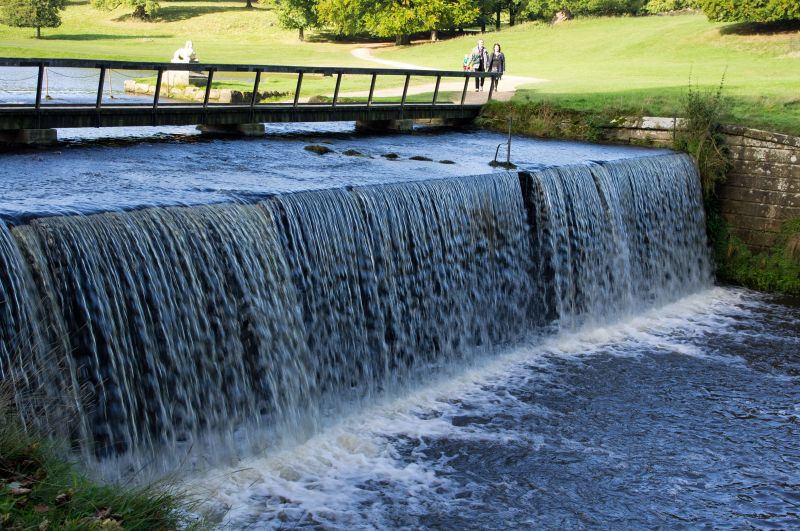
Entry Name: Weir and Cascade at Outlet from the Lake with Flanking Wall and Ford
Listing Date: 11 June 1986
Grade: II
Source: Historic England
Source ID: 1173726
English Heritage Legacy ID: 331061
ID on this website: 101173726
Location: North Yorkshire, HG4
County: North Yorkshire
District: Harrogate
Civil Parish: Lindrick with Studley Royal and Fountains
Traditional County: Yorkshire
Lieutenancy Area (Ceremonial County): North Yorkshire
Tagged with: Weir
SE 2869 LINDRICK WITH STUDLEY STUDLEY PARK ROYAL AND FOUNTAINS 9/57 Weir and cascade at outlet from the Lake, with flanking wall and ford
GV II
Weir and cascade with flanking walls and ford. c1720 by John Simpson, mason, for John Aislabie. Gritstone. Ford of stone setts, weir and flanking walls of large blocks. Ford approximately 3 metres wide, weir approximately 3 metres high. Flanking walls have segmental-arched sluice outlets. The River Skell emerges from the Lake over the ford and drops into its natural bed to continue on a meandering course through the valley known as Seven Bridge Walk. The lake is almost entirely man-made and the weir forms the northern limit to Aislabie's planned garden scheme. Below the weir the natural features of the landscape predominate. The ford carried a carriage drive which encircled the lake and continued down the stream through Mackershaw Wood. It was not then possible to cross the River Skell on foot at any point between the Rustic Bridge (qv) and Seven Bridges Walk.
Listing NGR: SE2818069272
External links are from the relevant listing authority and, where applicable, Wikidata. Wikidata IDs may be related buildings as well as this specific building. If you want to add or update a link, you will need to do so by editing the Wikidata entry.


Other nearby listed buildings