Latitude: 52.8564 / 52°51'23"N
Longitude: -3.0583 / 3°3'29"W
OS Eastings: 328837
OS Northings: 329291
OS Grid: SJ288292
Mapcode National: GBR 73.S1M6
Mapcode Global: WH78R.ZGTK
Plus Code: 9C4RVW4R+HM
Entry Name: 8 and 10, Upper Brook Street
Listing Date: 15 May 1986
Grade: II
Source: Historic England
Source ID: 1176678
English Heritage Legacy ID: 255580
ID on this website: 101176678
Location: Croesoswallt, Shropshire, SY11
County: Shropshire
Civil Parish: Oswestry
Built-Up Area: Croesowallt
Traditional County: Shropshire
Lieutenancy Area (Ceremonial County): Shropshire
Church of England Parish: Oswestry St Oswald King and Martyr
Church of England Diocese: Lichfield
Tagged with: Building
SJ 2829 SE OSWESTRY C.P. UPPER BROOK STREET (south side) 15/106 Nos. 8 and 10 - GV II
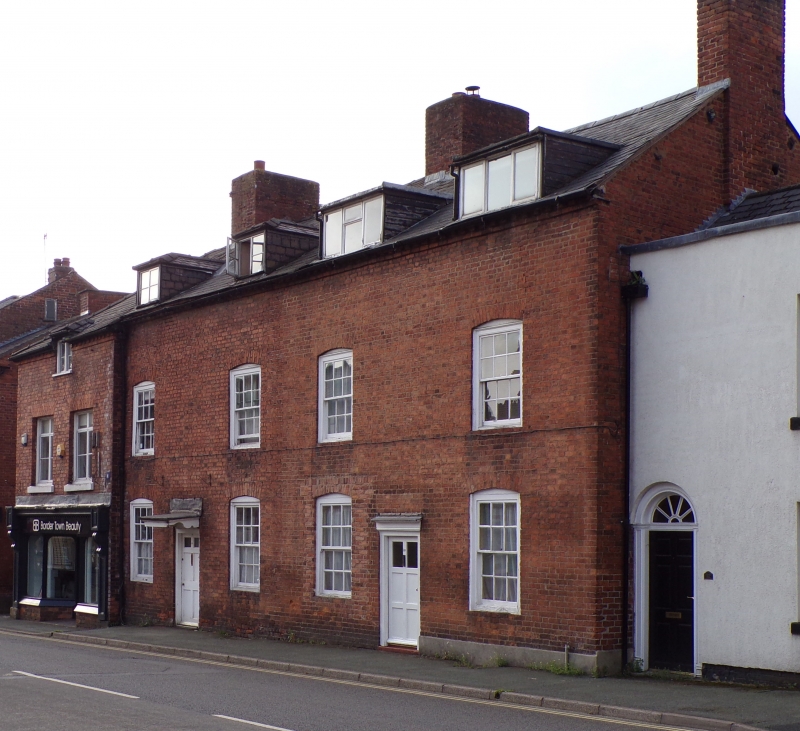
Pair of houses. Circa 1800 with later additions and alterations. Red brick, slate roof with prominent ridge stacks to left and centre and internal end stack to right. 2 storeys and attic, dentilled eaves cornice; 4-window front, glazing bar sashes with segmental heads, two C19 hip-roofed dormers to left and 2 prominent C20 flat-roofed dormers to right; entrance to No. 8 (left) has plain doorcase with moulded hood on modillion brackets, C20 six-panel door; No. 10 (right) has C20 half-glazed door with C20 shop window to left replacing original sash. Included for group value.
Listing NGR: SJ2884629286
External links are from the relevant listing authority and, where applicable, Wikidata. Wikidata IDs may be related buildings as well as this specific building. If you want to add or update a link, you will need to do so by editing the Wikidata entry.


Other nearby listed buildings