Latitude: 52.785 / 52°47'6"N
Longitude: -2.7082 / 2°42'29"W
OS Eastings: 352333
OS Northings: 321064
OS Grid: SJ523210
Mapcode National: GBR 7K.XNNZ
Mapcode Global: WH8BG.C8M8
Plus Code: 9C4VQ7PR+2P
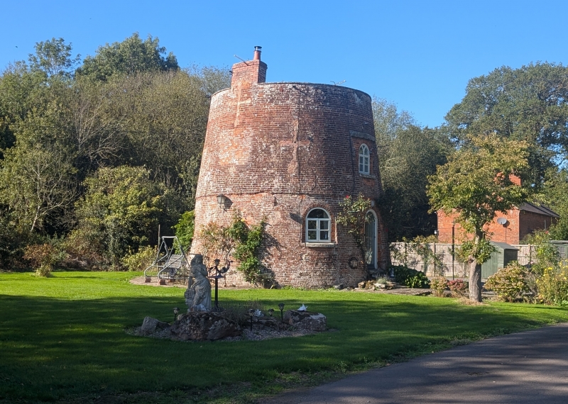
Entry Name: The Round House
Listing Date: 29 October 1986
Grade: II
Source: Historic England
Source ID: 1177607
English Heritage Legacy ID: 260041
ID on this website: 101177607
Location: Shropshire, SY4
County: Shropshire
Civil Parish: Hadnall
Traditional County: Shropshire
Lieutenancy Area (Ceremonial County): Shropshire
Church of England Parish: Grinshill All Saints
Church of England Diocese: Lichfield
Tagged with: House
SJ 52 SW HADNALL C.P. MILL LANE (north-west side)
8/47 No. 5 (The Round - House)
- II
Windmill, now house. Dated 1787, remodelled in the early C19 and altered in the mid-C20. Red brick, Circular plan with tapering sides; Gothick style. 2 storeys. First floor slightly set forward. Integral brick stack to south. Round-arched 2-light wooden casements with Y-tracery. Glazed door to east with Y-tracery, flanking windows, and first-floor window above in blocked larger opening with cambered stone lintel and cill. Boarded round-arched door to west with window to right and first-floor window above. There are a number of blocked square openings in the wall, some with later smaller inserted windows, and there are also a series of blocked decorative cruciform loops. Datestone in parapet above door to east is illegible except for date at time of survey (December 1985). Interior: large beams and joists. Segmental-arched brick fireplace. Pevsner calls this the Waterloo Windmill and says that it was built by Viscount Hill (d.1842) to commemorate his military exploits. If there is a Waterloo connection then the C18 date must be a misreading (though it is quoted elsewhere). An old photograph owned by the present occupants (December 1985) shows the mill with a ruined third stage. It is also possible that the building was never intended to be a working mill and was built as a partial ruin, or turned into one later, though the large blocked openings would seem to deny this. It seems most likely that it does date from the C18 and only later acquired the Waterloo connections. Pevsner, p.139; W.A. Seaby and A.C. Smith, Windmills in Shropshire, Hereford and Worcester. A Contemporary Survey, Stevenage Museum Publications (1983); Shropshire Records Office, Grinshill tithe map (1838), document no. 4535/T/1.
Listing NGR: SJ5233321064
External links are from the relevant listing authority and, where applicable, Wikidata. Wikidata IDs may be related buildings as well as this specific building. If you want to add or update a link, you will need to do so by editing the Wikidata entry.


Other nearby listed buildings