Latitude: 54.2724 / 54°16'20"N
Longitude: -1.8407 / 1°50'26"W
OS Eastings: 410474
OS Northings: 486319
OS Grid: SE104863
Mapcode National: GBR HML1.96
Mapcode Global: WHC6X.PWP2
Plus Code: 9C6W75C5+XP
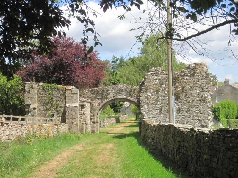
Entry Name: Coverham Abbey Gatehouse
Listing Date: 13 February 1967
Last Amended: 24 January 1986
Grade: II*
Source: Historic England
Source ID: 1178895
English Heritage Legacy ID: 321761
ID on this website: 101178895
Location: Coverham, North Yorkshire, DL8
County: North Yorkshire
District: Richmondshire
Civil Parish: Coverham with Agglethorpe
Traditional County: Yorkshire
Lieutenancy Area (Ceremonial County): North Yorkshire
Tagged with: Gatehouse
SE 18 NW COVERHAM WITH AGGLETHORPE COVERHAM ABBEY
10/12 Coverham Abbey Gatehouse (Formerly listed as Abbey 13/2/67 Gateway)
GV II*
Remains of gatehouse. Early C16 and later. Rubble with ashlar dressings, stone slate roofs. Inner arch and outer responds of vaulted gateway survive, with flanking gatehouse buildings. Semicircular arch of 2 chamfered orders with moulded imposts. Flanking buildings each have small light vent in original outer end walls and south building has chamfered single-light window to inner end wall. The side walls have been repaired to form animal shelters, which have rubble barrel-vaulted ceilings below later roofs.
Listing NGR: SE1047486318
External links are from the relevant listing authority and, where applicable, Wikidata. Wikidata IDs may be related buildings as well as this specific building. If you want to add or update a link, you will need to do so by editing the Wikidata entry.


Other nearby listed buildings