Latitude: 50.8961 / 50°53'46"N
Longitude: -1.5062 / 1°30'22"W
OS Eastings: 434826
OS Northings: 110855
OS Grid: SU348108
Mapcode National: GBR 76D.Q0W
Mapcode Global: FRA 76QQ.YWK
Plus Code: 9C2WVFWV+FG
Entry Name: Lychgate West of Colbury Christ Church
Listing Date: 10 June 1987
Last Amended: 31 January 1989
Grade: II
Source: Historic England
Source ID: 1179043
English Heritage Legacy ID: 143472
ID on this website: 101179043
Location: Christ Church, Colbury, New Forest, Hampshire, SO40
County: Hampshire
District: New Forest
Civil Parish: Ashurst and Colbury
Traditional County: Hampshire
Lieutenancy Area (Ceremonial County): Hampshire
Church of England Parish: Colbury Christ Church
Church of England Diocese: Winchester
Tagged with: Lychgate
TOTTON AND ELING DEERLEAP LANE SU 31 SW 4/19 Lychgate west of Colbury Christchurch II the address shall be amended to read ASHURST AND COLBURY DEERLEAP LANE Lychgate west of Colbury Christ Church
------------------------------------
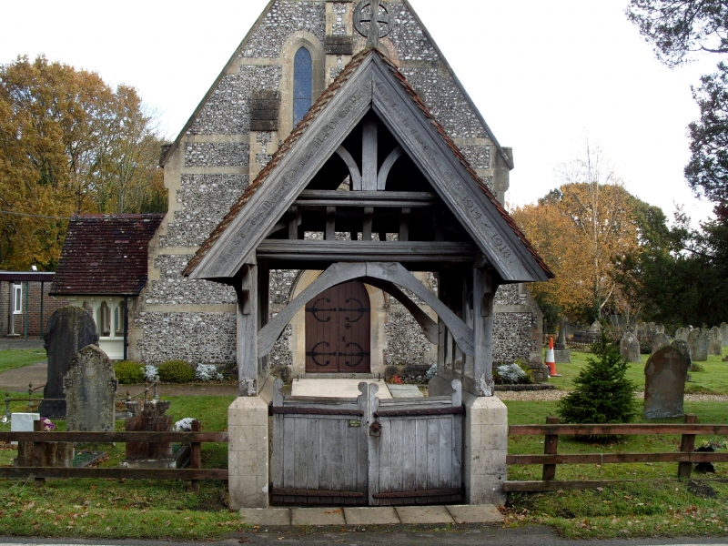
TOTTON AND ELING DEERLEAP-LANE SU 31 SW 4/19 Lychgate west of Colbury Christchurch GV II Lychgate. Circa 1870, probably by B Ferrey. Ashlar stone plinth walls, timber- frame, plain tile roof. Longtudinal plinth walls to timber-framed structure with each end truss of curved braces from short uprights to tie beam. On the 5 brackets to jettied collar surmounted by King-post. Carved bargeboards with inscriptions. Inside pair of gates.
Listing NGR: SU3432111080
External links are from the relevant listing authority and, where applicable, Wikidata. Wikidata IDs may be related buildings as well as this specific building. If you want to add or update a link, you will need to do so by editing the Wikidata entry.


Other nearby listed buildings