Latitude: 54.2793 / 54°16'45"N
Longitude: -1.7322 / 1°43'56"W
OS Eastings: 417531
OS Northings: 487104
OS Grid: SE175871
Mapcode National: GBR JLBY.SR
Mapcode Global: WHC6Z.CPCS
Plus Code: 9C6W77H9+P4
Entry Name: Manor Farmhouse
Listing Date: 15 February 1967
Last Amended: 25 June 1985
Grade: II
Source: Historic England
Source ID: 1179637
English Heritage Legacy ID: 321738
ID on this website: 101179637
Location: Thornton Steward, North Yorkshire, HG4
County: North Yorkshire
District: Richmondshire
Civil Parish: Thornton Steward
Traditional County: Yorkshire
Lieutenancy Area (Ceremonial County): North Yorkshire
Tagged with: Farmhouse
SE 18 NE THORNTON STEWARD THORNTON STEWARD (south side) 4/129 Manor Farmhouse 15.2.67 (Formerly listed as The Old Manor House under General) GV II
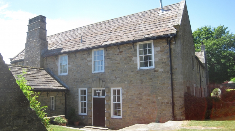
Farmhouse. C17 and mid C20. Rubble, stone slate roofs. E-shaped plan, but right-hand half a C20 reconstruction. 2 storeys. Quoins. Left wing: 3-light mullioned and transomed window on each floor. Shaped kneelers, ashlar coping, finial to apex. In angle, lead-roofed projection with round- headed sash window with glazing bars, shaped kneelers, ashlar coping. In centre, quoined surround to part-glazed door, sash windows with glazing bars. Rear elevation: doorway with chamfered quoined, stone surround and triangular soffit to lintel. Left return: projecting chimneybreast, partly corbelled out on first floor.
Listing NGR: SE1753187104
External links are from the relevant listing authority and, where applicable, Wikidata. Wikidata IDs may be related buildings as well as this specific building. If you want to add or update a link, you will need to do so by editing the Wikidata entry.


Other nearby listed buildings