Latitude: 51.5763 / 51°34'34"N
Longitude: -0.9897 / 0°59'23"W
OS Eastings: 470104
OS Northings: 186869
OS Grid: SU701868
Mapcode National: GBR B2Y.2L7
Mapcode Global: VHDW6.SMMY
Plus Code: 9C3XH2G6+G4
Entry Name: 7 and 8, Watlington Street
Listing Date: 13 February 1985
Grade: II
Source: Historic England
Source ID: 1181153
English Heritage Legacy ID: 247136
ID on this website: 101181153
Location: Nettlebed, South Oxfordshire, RG9
County: Oxfordshire
District: South Oxfordshire
Civil Parish: Nettlebed
Built-Up Area: Nettlebed
Traditional County: Oxfordshire
Lieutenancy Area (Ceremonial County): Oxfordshire
Church of England Parish: Nettlebed with Highmoor
Church of England Diocese: Oxford
Tagged with: Building
NETTLEBED WATLINGTON STREET SP7086 (West side) 13/114 Nos.7 and 8 GV II
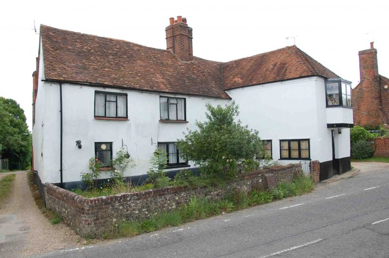
House, now two cottages. C17 with C19 extension to right. Rendered, probably on timber-framing; plain old tile roof; stack of C17 bricks. Lobby entry plan. 2-storey, 3-window range. Central C20 ribbed door with gabled hood. Two C19 casements to left. C20 sash door to front of projecting extension to right. Two 3-light C20 metal casements to first floor left. C20 angled bay with flat roof to first floor front of extension. Centre ridge stack. Timber-framing visible under render to right return. Interior not inspected.
Listing NGR: SU7010486869
External links are from the relevant listing authority and, where applicable, Wikidata. Wikidata IDs may be related buildings as well as this specific building. If you want to add or update a link, you will need to do so by editing the Wikidata entry.


Other nearby listed buildings