Latitude: 52.3076 / 52°18'27"N
Longitude: -1.7251 / 1°43'30"W
OS Eastings: 418842
OS Northings: 267754
OS Grid: SP188677
Mapcode National: GBR 4KF.8PG
Mapcode Global: VHBXF.18WB
Plus Code: 9C4W875F+2X
Entry Name: Lowsonford Bridge
Listing Date: 22 November 1989
Grade: II
Source: Historic England
Source ID: 1184553
English Heritage Legacy ID: 308363
ID on this website: 101184553
Location: Lowsonford, Warwick, Warwickshire, B95
County: Warwickshire
District: Warwick
Civil Parish: Rowington
Traditional County: Warwickshire
Lieutenancy Area (Ceremonial County): Warwickshire
Church of England Parish: Rowington St Laurence
Church of England Diocese: Coventry
Tagged with: Bridge
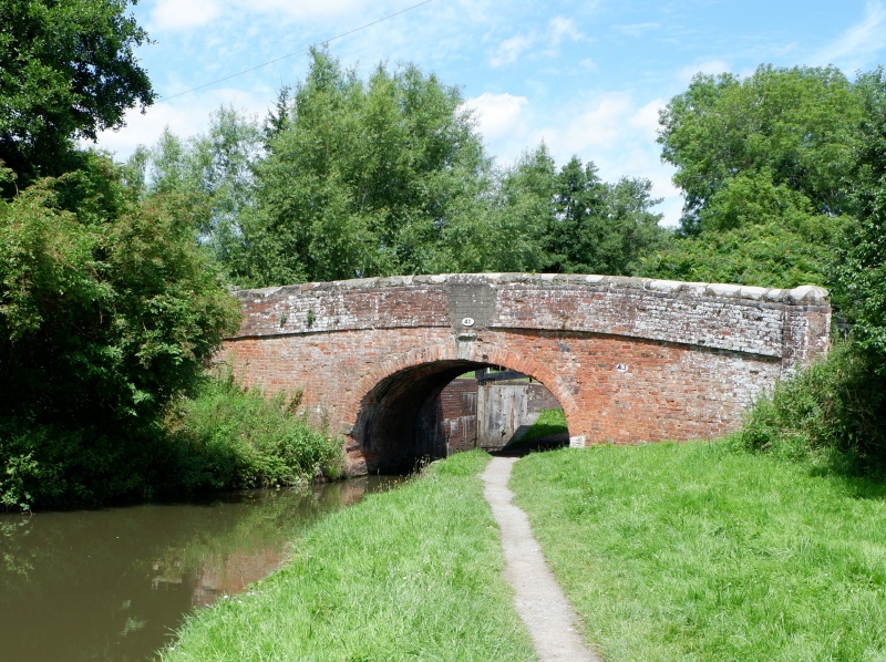
ROWINGTON NEW ROAD SP16NE Lowsonford 3/99 Lowsonford Bridge 22.11.89 6V II Road bridge. Circa 1816 for the Stratford-on-Avon Canal. Brick single-arched bridge with stone impost blocks and keystones to each face of arch. Flat brick bands to base of plain brick parapets with stone copings. History: the Stratford-on-Avon Canal was started in 1793 and opened in 1816. This bridge is No.41. Included for group value. [ 96]
Listing NGR: SP1884267754
External links are from the relevant listing authority and, where applicable, Wikidata. Wikidata IDs may be related buildings as well as this specific building. If you want to add or update a link, you will need to do so by editing the Wikidata entry.


Other nearby listed buildings