Approximate Location Map
Large Map »
Latitude: 53.6818 / 53°40'54"N
Longitude: -1.8346 / 1°50'4"W
OS Eastings: 411022
OS Northings: 420606
OS Grid: SE110206
Mapcode National: GBR HTMV.MX
Mapcode Global: WHC9T.SQKB
Plus Code: 9C5WM5J8+P5
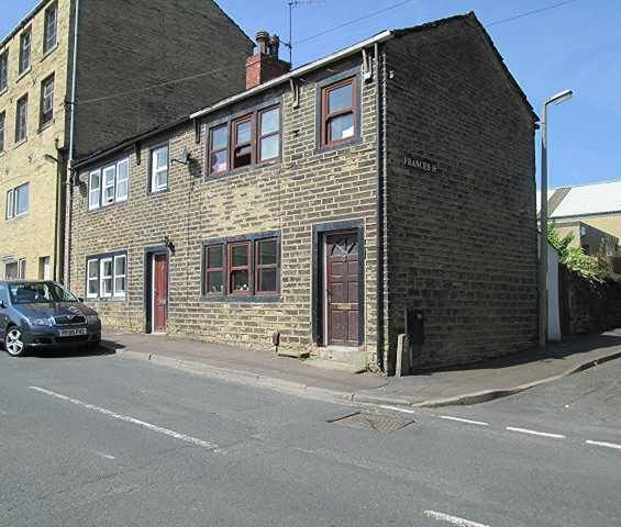
Entry Name: 18 and 20, South Lane
Listing Date: 6 June 1983
Grade: II
Source: Historic England
Source ID: 1184975
English Heritage Legacy ID: 338529
ID on this website: 101184975
Location: Elland, Calderdale, West Yorkshire, HX5
County: Calderdale
Electoral Ward/Division: Elland
Parish: Non Civil Parish
Built-Up Area: Elland
Traditional County: Yorkshire
Lieutenancy Area (Ceremonial County): West Yorkshire
Church of England Parish: Elland All Saints,
Church of England Diocese: Leeds
Tagged with: Building
ELLAND SOUTH LANE
se 110205
2/105 Nos 18 and 20
II
2 cottages, early C19. Hammer-dressed stone, stone slate roof. 2 storeys. Both
have door with single stone heals and jambs and 3-light flat faced mullioned window
with same above with a single light sash over door.
Listing NGR: SE1102220606
External links are from the relevant listing authority and, where applicable, Wikidata. Wikidata IDs may be related buildings as well as this specific building. If you want to add or update a link, you will need to do so by editing the Wikidata entry.


Other nearby listed buildings
