Latitude: 51.8028 / 51°48'10"N
Longitude: -2.4501 / 2°27'0"W
OS Eastings: 369062
OS Northings: 211667
OS Grid: SO690116
Mapcode National: GBR FY.XLVJ
Mapcode Global: VH86Z.HY3C
Plus Code: 9C3VRG3X+4X
Entry Name: Velindra
Listing Date: 25 January 1985
Grade: II
Source: Historic England
Source ID: 1186431
English Heritage Legacy ID: 354009
ID on this website: 101186431
Location: Newnham, Forest of Dean, Gloucestershire, GL14
County: Gloucestershire
District: Forest of Dean
Civil Parish: Newnham
Built-Up Area: Newnham
Traditional County: Gloucestershire
Lieutenancy Area (Ceremonial County): Gloucestershire
Church of England Parish: Newnham St Peter
Church of England Diocese: Gloucester
Tagged with: Building
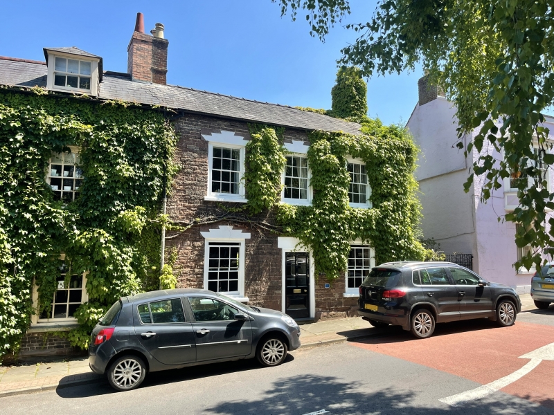
SO 61 SE NEWNHAM HIGH STREET
(east side)
2/40
Velindra
-
GV II
Dwelling. Mid C18. Squared and coursed sandstone, Welsh slate roof. Return
wing, left. Two storeys, 3-windowed, sashes with glazing bars in wide sur-
rounds. New door centrally in moulded surround.
Listing NGR: SO6906211667
External links are from the relevant listing authority and, where applicable, Wikidata. Wikidata IDs may be related buildings as well as this specific building. If you want to add or update a link, you will need to do so by editing the Wikidata entry.


Other nearby listed buildings