Latitude: 51.169 / 51°10'8"N
Longitude: 0.6197 / 0°37'10"E
OS Eastings: 583243
OS Northings: 144351
OS Grid: TQ832443
Mapcode National: GBR QTV.MHP
Mapcode Global: VHJMV.PWH5
Plus Code: 9F325J99+JV
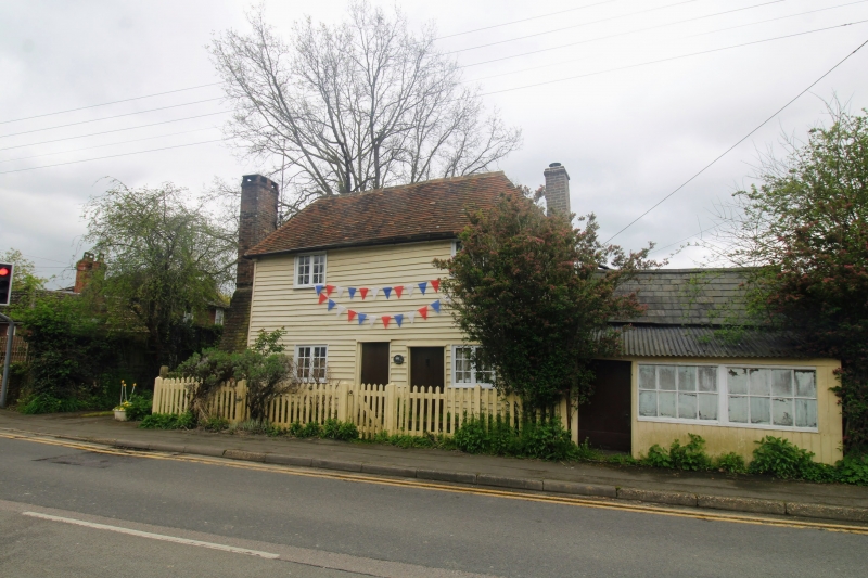
Entry Name: 1 and 2, Moat Road
Listing Date: 21 October 1986
Grade: II
Source: Historic England
Source ID: 1187069
English Heritage Legacy ID: 174312
ID on this website: 101187069
Location: Headcorn, Maidstone, Kent, TN27
County: Kent
District: Maidstone
Civil Parish: Headcorn
Built-Up Area: Headcorn
Traditional County: Kent
Lieutenancy Area (Ceremonial County): Kent
Tagged with: Building
HEADCORN MOAT ROAD TQ 8344 (South side) 10/86 Nos. 1 and 2
II
Cottages. Late C18 or early C19. Timber framed, weatherboarded, with plain tile roof. Double depth. 2 storeys. Hipped roof, hips returning with lower ridges. Large projecting brick stack to left gable end, and slender projecting stack to right. Regular 2-window front of small 2-light casements, set towards right and left ends. 2 boarded doors set towards centre. Interior not inspected.
Listing NGR: TQ8324644350
External links are from the relevant listing authority and, where applicable, Wikidata. Wikidata IDs may be related buildings as well as this specific building. If you want to add or update a link, you will need to do so by editing the Wikidata entry.


Other nearby listed buildings