Latitude: 52.1934 / 52°11'36"N
Longitude: -1.7035 / 1°42'12"W
OS Eastings: 420365
OS Northings: 255061
OS Grid: SP203550
Mapcode National: GBR 4LT.G4S
Mapcode Global: VHBY0.F49C
Plus Code: 9C4W57VW+9J
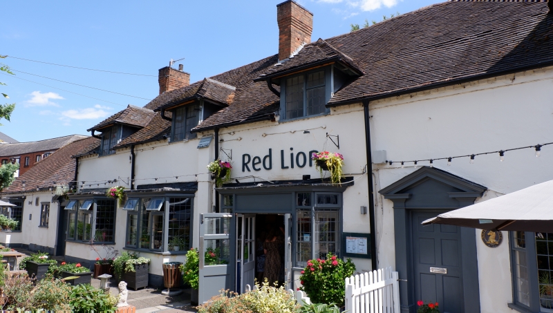
Entry Name: Red Lion Inn
Listing Date: 9 February 1972
Grade: II
Source: Historic England
Source ID: 1187864
English Heritage Legacy ID: 366433
ID on this website: 101187864
Location: Stratford-upon-Avon, Stratford-on-Avon, Warwickshire, CV37
County: Warwickshire
District: Stratford-on-Avon
Civil Parish: Stratford-upon-Avon
Built-Up Area: Stratford-upon-Avon
Traditional County: Warwickshire
Lieutenancy Area (Ceremonial County): Warwickshire
Church of England Parish: Stratford on Avon Holy Trinity
Church of England Diocese: Coventry
Tagged with: Inn
STRATFORD-UPON-AVON
SP2055SW WARWICK ROAD 604-1/8/236 (East side) 09/02/72 Red Lion Inn
GV II
Public house. Late C18 or possibly earlier, restored and altered. Stuccoed brick; partly-renewed tile roof with brick end stack and 2 stacks to front of ridge. Single storey plus attic; 5-window range; right end probably later; single-storey wing to left return. Top modillioned brick cornice. Central entrance in canted bay window has paired half-glazed doors; entrance to right of centre has doorcase with pilasters and open pediment; similar entrance to single-storey wing. 3 large and 2 small canted bay windows to ground floor have cornices over leaded glazing; similar canted bay to wing. 1st floor has 3 hipped dormers with C20 casements, one larger hipped dormer with 3-light casement and window with sill and 2-light casement to right end. Right return has C20 extension. Rear has hipped wing and late C20 flat-roofed additions; 6 varied hipped dormers. INTERIOR: some exposed beams. The building closes the view down Guild Street, and also contributes to the views down Warwick Road, Waterside and Bridge Foot; the Stratford canal runs behind.
Listing NGR: SP2036555061
External links are from the relevant listing authority and, where applicable, Wikidata. Wikidata IDs may be related buildings as well as this specific building. If you want to add or update a link, you will need to do so by editing the Wikidata entry.


Other nearby listed buildings