Latitude: 52.1942 / 52°11'39"N
Longitude: -1.7046 / 1°42'16"W
OS Eastings: 420286
OS Northings: 255151
OS Grid: SP202551
Mapcode National: GBR 4LT.FVF
Mapcode Global: VHBY0.D3PQ
Plus Code: 9C4W57VW+M4
Entry Name: 19 and 20, Payton Street
Listing Date: 9 February 1972
Grade: II
Source: Historic England
Source ID: 1187833
English Heritage Legacy ID: 366343
ID on this website: 101187833
Location: Stratford-upon-Avon, Stratford-on-Avon, Warwickshire, CV37
County: Warwickshire
District: Stratford-on-Avon
Civil Parish: Stratford-upon-Avon
Built-Up Area: Stratford-upon-Avon
Traditional County: Warwickshire
Lieutenancy Area (Ceremonial County): Warwickshire
Church of England Parish: Stratford on Avon Holy Trinity
Church of England Diocese: Coventry
Tagged with: Building
STRATFORD-UPON-AVON
SP2055SW PAYTON STREET 604-1/8/164 (South side) 09/02/72 Nos.19 AND 20
GV II
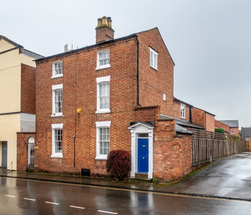
Pair of town houses. Early to mid C19. Brick with buff headers; slate roof with brick cross-axial stack. Double-depth plan. Georgian style. 3 storeys; 2-window range. Modillioned brick cornice. Entrance to No.20 to right return in lean-to outshut has doorcase with moulded pilasters and bracketed open pediment, narrow overlight to 4-fielded-over-2-flush-panel door; entry in wall to right. Windows have sills, and painted rubbed brick cambered arches over 12-pane sashes, 6-pane sashes to 2nd floor. Area wall with round-headed entry to left end. Left return has hipped porch with front entrance to No.19 as to No.20 but with overlight-style fretwork fascia to canopy. 2-storey rear range. Part of the early C19 development of northern Stratford, known as New Town.
Listing NGR: SP2028655151
External links are from the relevant listing authority and, where applicable, Wikidata. Wikidata IDs may be related buildings as well as this specific building. If you want to add or update a link, you will need to do so by editing the Wikidata entry.


Other nearby listed buildings