Approximate Location Map
Large Map »
Latitude: 51.6337 / 51°38'1"N
Longitude: -0.0744 / 0°4'27"W
OS Eastings: 533365
OS Northings: 194517
OS Grid: TQ333945
Mapcode National: GBR H6.PX4
Mapcode Global: VHGQF.N6JG
Plus Code: 9C3XJWMG+F6
Entry Name: Wall to East of Salisbury House
Listing Date: 31 January 1974
Last Amended: 10 December 1975
Grade: II
Source: Historic England
Source ID: 1188630
English Heritage Legacy ID: 200557
ID on this website: 101188630
Location: Bush Hill Park, Enfield, London, N9
County: London
District: Enfield
Electoral Ward/Division: Bush Hill Park
Parish: Non Civil Parish
Built-Up Area: Enfield
Traditional County: Middlesex
Lieutenancy Area (Ceremonial County): Greater London
Church of England Parish: St Stephen Bush Hill Park
Church of England Diocese: London
Tagged with: Wall
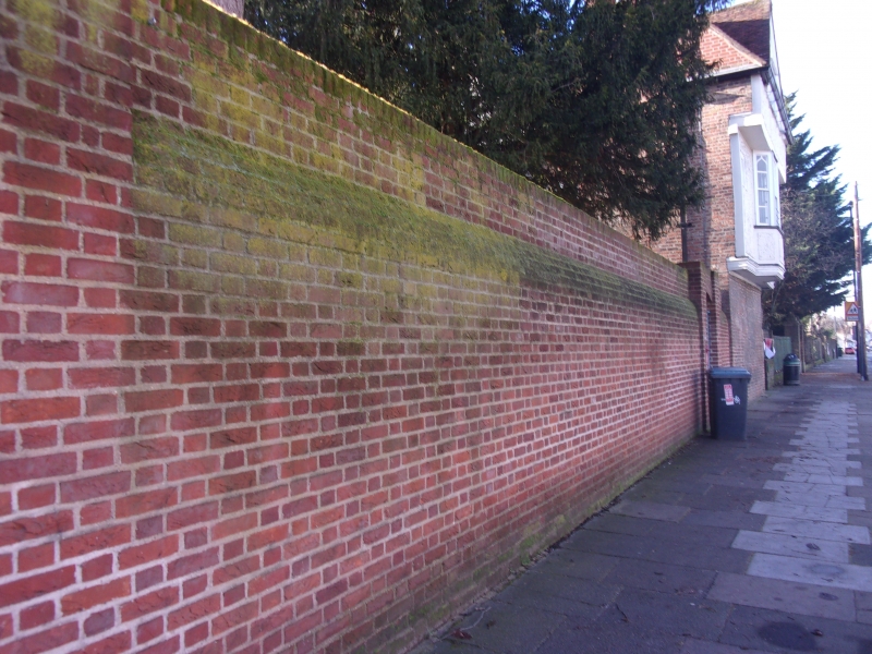
1.
4411 BURY STREET WEST N9
Wall to East of
Salisbury House
TQ 39 SW 23/51
II
2.
Probably C17 red brick wall, with sloped coping, later heightened by 7 courses
and a further coping.
Listing NGR: TQ3336594517
External links are from the relevant listing authority and, where applicable, Wikidata. Wikidata IDs may be related buildings as well as this specific building. If you want to add or update a link, you will need to do so by editing the Wikidata entry.


Other nearby listed buildings
