Latitude: 54.2105 / 54°12'37"N
Longitude: -1.2161 / 1°12'57"W
OS Eastings: 451222
OS Northings: 479704
OS Grid: SE512797
Mapcode National: GBR MMYR.JD
Mapcode Global: WHD8R.9F4H
Plus Code: 9C6W6Q6M+6H
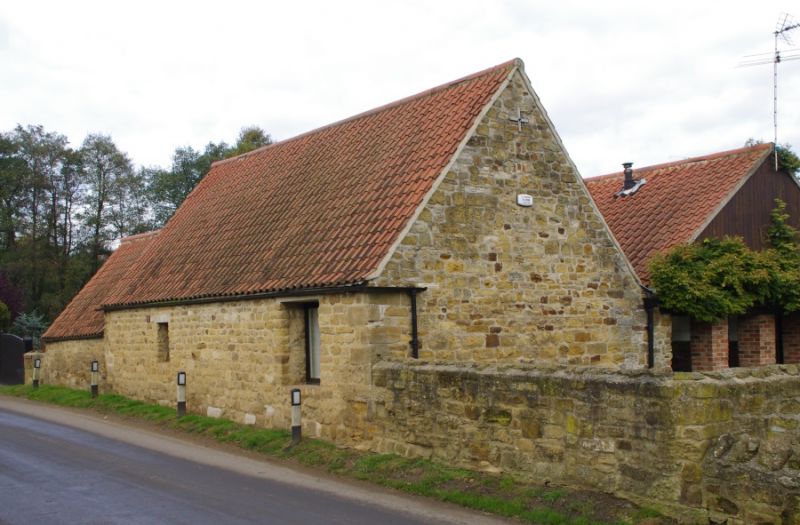
Entry Name: Barn Approximately 30 Metres to North-West of Village Farm
Listing Date: 20 December 1988
Grade: II
Source: Historic England
Source ID: 1190626
English Heritage Legacy ID: 332876
ID on this website: 101190626
Location: Kilburn, North Yorkshire, YO61
County: North Yorkshire
District: Hambleton
Civil Parish: Kilburn High and Low
Traditional County: Yorkshire
Lieutenancy Area (Ceremonial County): North Yorkshire
Tagged with: Barn
KILBURN HIGH AND LOW LOW KILBURN SE 5179 (west side) 8/18 Barn approximately 30 metres to north-west of Village Farm GV II Barn. Probably C16 cruck frame clad in early C18. Cruck frame clad in coursed squared stone. 3 internal bays. West (road) front: quoins, small opening to left of centre with wooden lintel and slats; wood-framed board door set under eaves at right end; steeply-pitched swept roof. Right return: row of square holes at tie- beam level; triangular pattern of bird-holes in gable. Interior: 3 pairs of crucks with collars, tie-beams and hakings for wall-ties now removed. Shed added to left gable and covered yard attached to rear not of special interest.
Listing NGR: SE5122279704
External links are from the relevant listing authority and, where applicable, Wikidata. Wikidata IDs may be related buildings as well as this specific building. If you want to add or update a link, you will need to do so by editing the Wikidata entry.


Other nearby listed buildings