Approximate Location Map
Large Map »
Latitude: 51.4847 / 51°29'5"N
Longitude: -0.1834 / 0°11'0"W
OS Eastings: 526231
OS Northings: 177761
OS Grid: TQ262777
Mapcode National: GBR 3P.0Y
Mapcode Global: VHGQY.RYW6
Plus Code: 9C3XFRM8+VJ
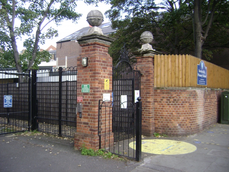
Entry Name: Pair of Gatepiers to Roman Catholic Servite Primary School
Listing Date: 15 April 1969
Grade: II
Source: Historic England
Source ID: 1190762
English Heritage Legacy ID: 203789
ID on this website: 101190762
Location: West Brompton, Kensington and Chelsea, London, SW10
County: London
District: Kensington and Chelsea
Electoral Ward/Division: Redcliffe
Parish: Non Civil Parish
Built-Up Area: Kensington and Chelsea
Traditional County: Middlesex
Lieutenancy Area (Ceremonial County): Greater London
Church of England Parish: West Brompton St Mary with St Peter and St Jude
Church of England Diocese: London
Tagged with: Gatepost
TQ 2677 NW FULHAM ROAD SW3
60/3
15.4.69 Pair of Gatepiers to
Roman Catholic Servite
Primary School
II
Rebuilt early C18 brick piers with carved stone caps and ball finials. Later wrought
iron gate.
Listing NGR: TQ2623177761
External links are from the relevant listing authority and, where applicable, Wikidata. Wikidata IDs may be related buildings as well as this specific building. If you want to add or update a link, you will need to do so by editing the Wikidata entry.


Other nearby listed buildings
